Oude Noorden, Rotterdam

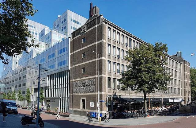
Gallery (1)
Map
Map
Facts and practical information
Oude Noorden is an area of north Rotterdam, Netherlands and is part of the borough Noord. It has approximately 18,000 inhabitants. The district has much pre World War I and World War II architecture still in existence. It has a vibrant though somewhat discreet artistic community. ()
Address
Noord (Oude Noorden)Rotterdam
ContactAdd
Social media
Add
Getting there by public transportation
Public transportation stops near this location
- Metro
- Bus
- Tram
- Train
 Metro
Metro
- Calculate routeBenthuizerstraat 4 min walk
- Calculate routeZwaanshals 5 min walk
- Calculate routeZaagmolenbrug 7 min walk
- Calculate routeVan den Hoonaardstraat 8 min walk
- Calculate routeZaagmolenbrug 7 min walk
- Calculate routeNoorderbrug 9 min walk
- Calculate routeCrooswijksebocht 11 min walk
- Calculate routeRotterdam Noord 14 min walk
- Calculate routeRotterdam Centraal 23 min walk
- Calculate routeStadhuis 21 min walk
- Calculate routeRotterdam Centraal 24 min walk
- Calculate routeOostplein 26 min walk
Day trips


Frequently Asked Questions (FAQ)
Which popular attractions are close to Oude Noorden?
Nearby attractions include Bergweg, Rotterdam (7 min walk), Liskwartier, Rotterdam (11 min walk), Agniesebuurt, Rotterdam (11 min walk), Crooswijk General Cemetery, Rotterdam (13 min walk).
How to get to Oude Noorden by public transport?
The nearest stations to Oude Noorden:
Tram
Bus
Train
Metro
Tram
- Benthuizerstraat • Lines: 8 (4 min walk)
- Zwaanshals • Lines: 8 (5 min walk)
Bus
- Zaagmolenbrug • Lines: 38 (7 min walk)
- Noorderbrug • Lines: 38 (9 min walk)
Train
- Rotterdam Noord (14 min walk)
- Rotterdam Centraal (23 min walk)
Metro
- Stadhuis • Lines: D, E (21 min walk)
- Rotterdam Centraal • Lines: D, E (24 min walk)