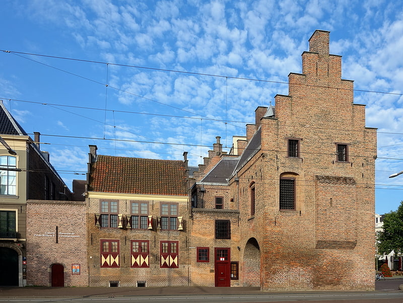
Spuipoort, The Hague
Facts and practical information
The Spuipoort: A Glimpse into the Medieval Heart of The Hague
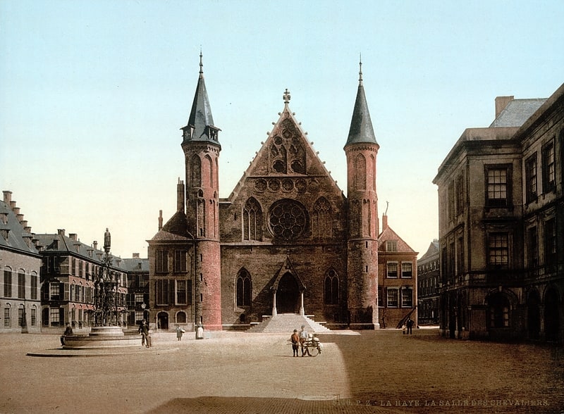
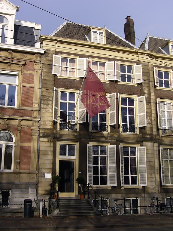
Nestled within the city of The Hague, Netherlands, the Spuipoort stands as a testament to the city's rich medieval heritage. This historical structure, a vestige of the city's ancient fortifications, once formed a part of the defensive walls that safeguarded The Hague in the Middle Ages. Today, it offers a unique window into the past, inviting visitors to explore an era long gone.
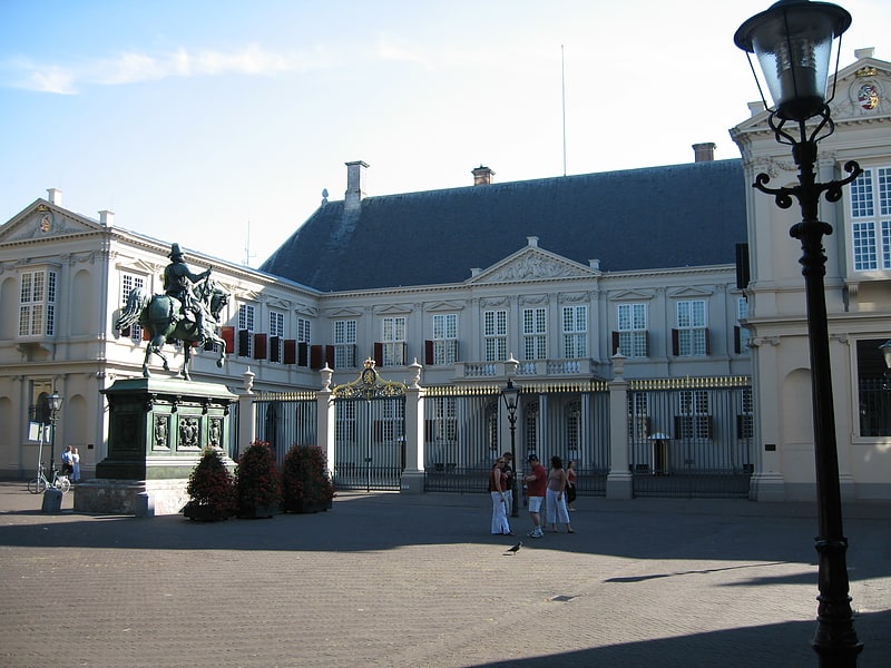
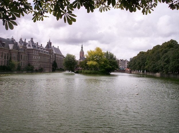
Constructed in the late 15th century, the Spuipoort was one of the eight gates that punctuated the city walls of The Hague. These fortifications were essential for the protection of the city, serving not only as defensive structures but also as control points for the influx of goods and people. The Spuipoort, in particular, was strategically positioned near the Binnenhof, the seat of the Dutch government, underscoring its significance within the city's defensive network.
Despite the passage of time and the transformation of The Hague into a modern city, the Spuipoort has survived the centuries. While many of the other gates were dismantled as the city expanded and the need for fortifications diminished, the Spuipoort remained, a solitary reminder of the city's medieval past.
The architecture of the Spuipoort is characteristic of the period, with its robust construction and functional design aimed at withstanding sieges and attacks. The gate's historical importance is further highlighted by its close proximity to other significant landmarks, such as the Binnenhof and the Hofvijver, the picturesque pond adjacent to the parliamentary complex.
Today, the Spuipoort no longer serves a defensive function but has become an integral part of The Hague's cultural heritage. It stands as a monument to the city's history, an architectural relic that continues to fascinate historians, architects, and tourists alike.
While the Spuipoort is not as grandiose as some of the more famous medieval structures in Europe, it offers a quiet dignity and a sense of continuity with the past. For those interested in the historical development of The Hague and the Netherlands, a visit to the Spuipoort is an opportunity to connect with the city's medieval roots and to reflect on the layers of history that have shaped the present.
Centrum (Voorhout)The Hague
- Metro
- Bus
- Tram
- Train
 Metro
Metro
- Calculate routeCentrum 3 min walk
- Calculate routeKneuterdijk 7 min walk
- Calculate routeNieuwe Haven 7 min walk
- Calculate routeCentrum 2 min walk
- Calculate routeSpui 3 min walk
- Calculate routeKalvermarkt-Stadhuis 4 min walk
- Calculate routeBuitenhof 5 min walk
- Calculate routeDen Haag Centraal 13 min walk
- Calculate routeDen Haag HS 19 min walk
- Calculate routeDen Haag Centraal 14 min walk

Frequently Asked Questions (FAQ)
Which popular attractions are close to Spuipoort?
How to get to Spuipoort by public transport?
Bus
- Centrum • Lines: 22, 24, 28 (3 min walk)
- Kneuterdijk • Lines: 22, 24, 28 (7 min walk)
Tram
- Centrum • Lines: 1, 15 (2 min walk)
- Spui • Lines: 2, 3, 34, 4, 6 (3 min walk)
Train
- Den Haag Centraal (13 min walk)
- Den Haag HS (19 min walk)
Metro
- Den Haag Centraal • Lines: E (14 min walk)