Nederlands Israëlitische Gemeente Den Haag, The Hague
Facts and practical information
The Nederlands Israëlitische Gemeente Den Haag, commonly known as the Jewish Community of The Hague, is a prominent Jewish congregation located in the city of The Hague, Netherlands. This historic community plays a significant role in the religious and cultural life of the city's Jewish population.
Established in the 18th century, the community has been a cornerstone of Jewish life in The Hague for over 300 years. It has witnessed the ebb and flow of Jewish history in the Netherlands, including the devastating impact of the Holocaust, which deeply affected the community and led to a dramatic decrease in its numbers.
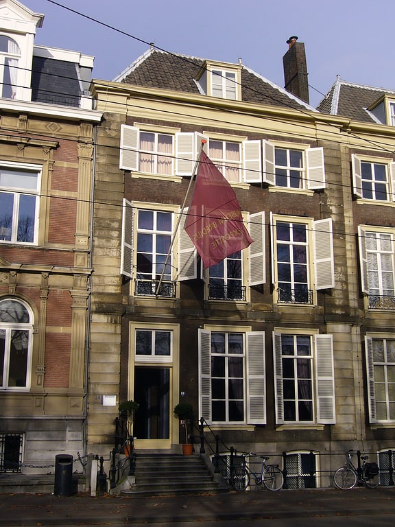
The synagogue associated with the Nederlands Israëlitische Gemeente Den Haag is a testament to the resilience and continuity of Jewish tradition in the city. The building itself is a remarkable architectural work, reflecting the styles and tastes of the period in which it was constructed. It serves as a house of worship, a center of learning, and a gathering place for the Jewish community.
The congregation follows Ashkenazi Orthodox Jewish traditions and offers a range of religious services, including Shabbat and holiday services, as well as educational programs for both children and adults. It is dedicated to preserving the Jewish heritage and provides a supportive environment for the spiritual and social needs of its members.
The Nederlands Israëlitische Gemeente Den Haag is also involved in interfaith dialogue and works to promote understanding and cooperation among different religious communities in The Hague. It stands as a symbol of the enduring presence of Jewish life in the Netherlands and contributes to the rich tapestry of cultural and religious diversity in the city.
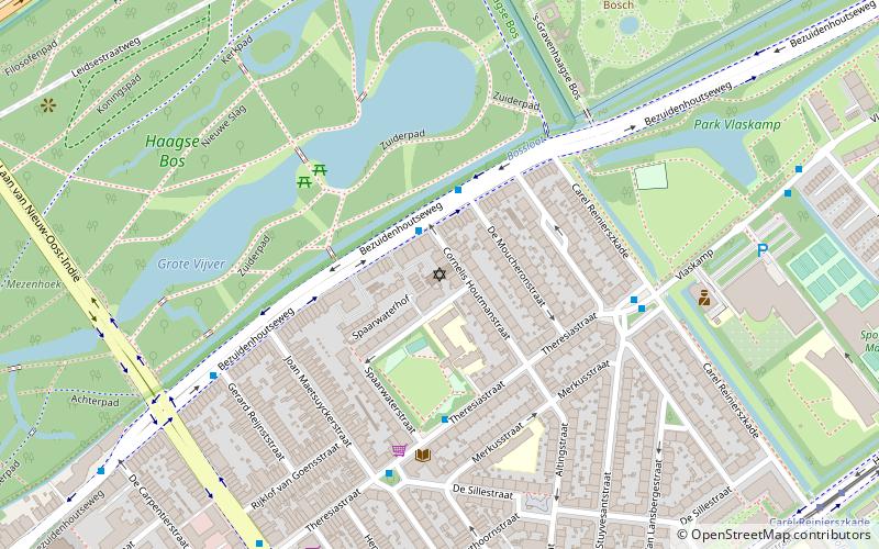
Bezuidenhout (Bezuidenhout-Oost)The Hague
- Metro
- Bus
- Tram
- Train
 Metro
Metro
- Calculate routeCarel Reinierszkade 2 min walk
- Calculate routeSpaarwaterstraat 4 min walk
- Calculate routeDe Eerensplein 5 min walk
- Calculate routeStuyvesantplein 10 min walk
- Calculate routeCarel Reinierszkade 10 min walk
- Calculate routeOostinje 11 min walk
- Calculate routeReigersbergenweg 14 min walk
- Calculate routeDen Haag Laan van NOI 19 min walk
- Calculate routeVoorburg 't Loo 30 min walk
- Calculate routeDen Haag Centraal 24 min walk


Frequently Asked Questions (FAQ)
Which popular attractions are close to Nederlands Israëlitische Gemeente Den Haag?
How to get to Nederlands Israëlitische Gemeente Den Haag by public transport?
Bus
- Carel Reinierszkade • Lines: 43, 44 (2 min walk)
- Spaarwaterstraat • Lines: 24 (4 min walk)
Tram
- Stuyvesantplein • Lines: 6 (10 min walk)
- Carel Reinierszkade • Lines: 6 (10 min walk)
Metro
- Den Haag Laan van NOI • Lines: E (19 min walk)
- Voorburg 't Loo • Lines: E (30 min walk)
Train
- Den Haag Centraal (24 min walk)