Second Harbour Crossing, Auckland
Map
Facts and practical information
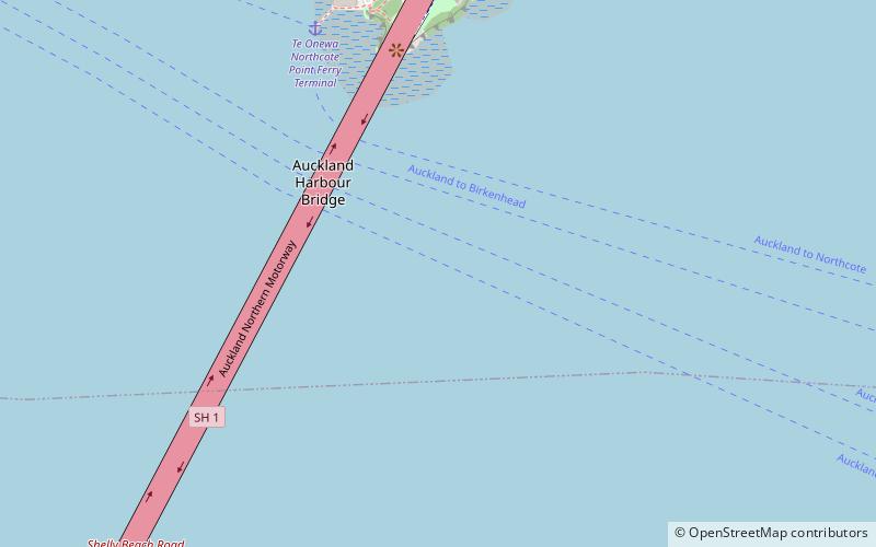
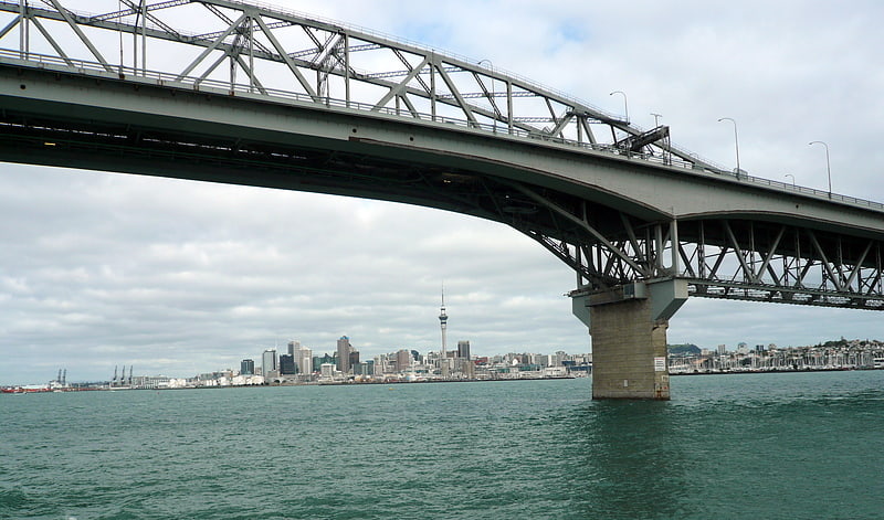
Second Harbour Crossing is the name given to the proposed second transport link across the Waitematā Harbour in Auckland, New Zealand. The second link would supplement the Auckland Harbour Bridge which is nearly at capacity and also provide more redundancy and public transport linkages between the Auckland city centre and the North Shore. It is sometimes also called the Third Harbour Crossing, as there is already an Upper Harbour Bridge. More recently, it is named Additional Waitematā Harbour Crossing in planning documents. ()
Coordinates: 36°49'51"S, 174°44'56"E
Address
North Shore (Northcote)Auckland
ContactAdd
Social media
Add
Getting there by public transportation
Public transportation stops near this location
- Bus
- Tram
- Train
- Ferry
 Bus
Bus
- Calculate routeTe Onewa Northcote Point Ferry Terminal 8 min walk
- Calculate routeSealink Hamer Street 17 min walk
- Calculate routeBayswater Ferry Terminal 29 min walk
- Calculate routeDowntown Pier 14 32 min walk
- Calculate routeJellicoe Street 21 min walk
- Calculate routeHalsey Street 24 min walk
- Calculate routeDaldy Street 25 min walk
- Calculate routeGaunt Street 27 min walk
- Calculate routeFanshawe Street / Daldy Street 27 min walk
- Calculate routeFanshawe Street / Victoria Park 28 min walk
- Calculate routeCurran Street 28 min walk
- Calculate routeArdmore Road 31 min walk
- Calculate routeBritomart 38 min walk
Day trips


Frequently Asked Questions (FAQ)
Which popular attractions are close to Second Harbour Crossing?
Nearby attractions include Auckland Harbour Bridge, Auckland (4 min walk), Westhaven Marina, Auckland (13 min walk), Waitematā Harbour, Auckland (16 min walk), Wynyard Quarter, Auckland (22 min walk).
How to get to Second Harbour Crossing by public transport?
The nearest stations to Second Harbour Crossing:
Ferry
Tram
Bus
Train
Ferry
- Te Onewa Northcote Point Ferry Terminal (8 min walk)
- Sealink Hamer Street (17 min walk)
Tram
- Jellicoe Street • Lines: Wynyard Loop (21 min walk)
- Halsey Street • Lines: Wynyard Loop (24 min walk)
Bus
- Fanshawe Street / Daldy Street • Lines: 82, Nx2 (27 min walk)
- Fanshawe Street / Victoria Park • Lines: 82, 923, 924, 931, 933, 95B, 95C, 97B, Nx1, Nx2 (28 min walk)
Train
- Britomart (38 min walk)