
Aïr Mountains Travel Guide
| Today in Niger: Korité (20 Mar) |
Facts and practical information
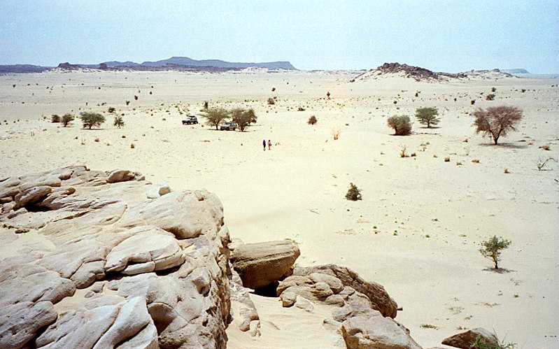
Located in the Agadez region of Niger, the Aïr Mountains are a breathtaking natural wonder that offer a unique and enriching experience for travelers. This stunning mountain range is characterized by its rugged beauty, with dramatic peaks, deep valleys, and vast expanses of desert landscape. The Aïr Mountains are a haven for outdoor enthusiasts, offering a wide range of activities such as hiking, rock climbing, and birdwatching.
One of the most iconic features of the Aïr Mountains is the picturesque town of Agadez, which serves as the gateway to this remote and captivating region. The town is known for its distinctive mud-brick architecture and vibrant markets, where visitors can immerse themselves in the rich culture and traditions of the local Tuareg people. Travelers can also explore the ancient Sultan's Palace and the towering Agadez Grand Mosque, which is a testament to the region's Islamic heritage.
For those seeking a deeper understanding of the Aïr Mountains and their significance, guided tours are available to explore the area's archaeological sites and rock art, which date back thousands of years. These ancient relics provide valuable insights into the history and prehistoric inhabitants of the region, making the Aïr Mountains a truly fascinating destination for history buffs and anthropologists.
In addition to its natural and cultural attractions, the Aïr Mountains offer a rare opportunity for travelers to disconnect from the modern world and immerse themselves in the tranquility of the desert. With its clear night skies and sparse population, the region provides an unparalleled setting for stargazing and experiencing the serene beauty of the Sahara.
Agadez
Aïr Mountains Attractions - What to See and Explore
Aïr Mountains offers many attractions and places to visit. Here are the most important ones: Adrar Bous, Tree of Ténéré. Below you will find a complete list of places worth visiting.


Best Time To Visit Aïr Mountains
Learn when is the best time to travel to Aïr Mountains weather-wise and what to expect in each season.