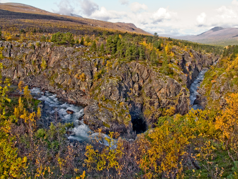
Øvre Dividal National Park

Facts and practical information
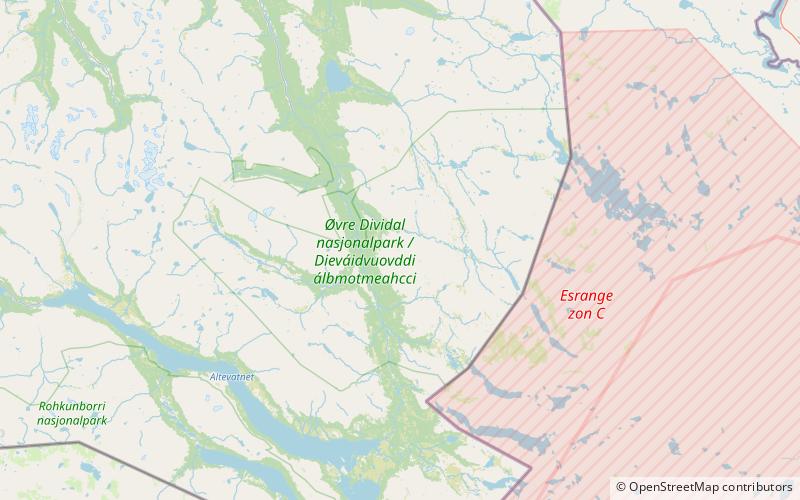
Øvre Dividal National Park is a national park in Målselv Municipality in Troms county, Norway. The park was opened in 1971 and has an area of 750 square kilometres. The original intention was to preserve a very little disturbed inland valley and mountain area. The hiking trail Nordkalottruta passes through the national park. ()
Troms
Best Ways to Experience the Park
Wildlife
AnimalsSee what popular animal species you can meet in this location.
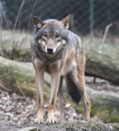
Gray wolf
The wolf, also known as the gray or grey wolf, is a captivating and majestic canine native to Eurasia and North America. There are over thirty recognized subspecies of Canis lupus, with the term "gray wolf" generally referring to the wild, non-domesticated varieties.
Mammals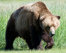
Brown (Grizzly) Bear
The brown bear, scientifically known as Ursus arctos, roams across Eurasia and North America. In North America, these majestic creatures are commonly referred to as grizzly bears. They are among the largest terrestrial carnivores, with only the polar bear rivaling...
Mammals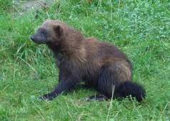
Wolverine
The wolverine, known scientifically as Gulo gulo, is the largest terrestrial member of the Mustelidae family. With its stout build and bear-like appearance, this formidable and solitary carnivore is renowned for its strength and ferocity, often taking down prey much...
Mammals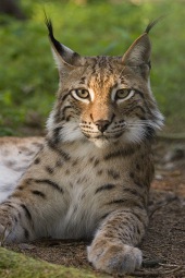
Eurasian Lynx
The lynx is a captivating medium-sized wild cat belonging to the genus Lynx, encompassing four recognized species. The name "lynx" is derived from the Greek word "λύγξ" which highlights the luminescent quality of its eyes.
Mammals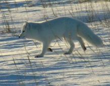
Arctic fox
The Arctic fox, also known as the white fox, polar fox, or snow fox, is a small yet extraordinary species native to the frigid regions of the Northern Hemisphere. This resilient creature is remarkably well-adapted to the severe cold, boasting thick fur that not only...
Mammals