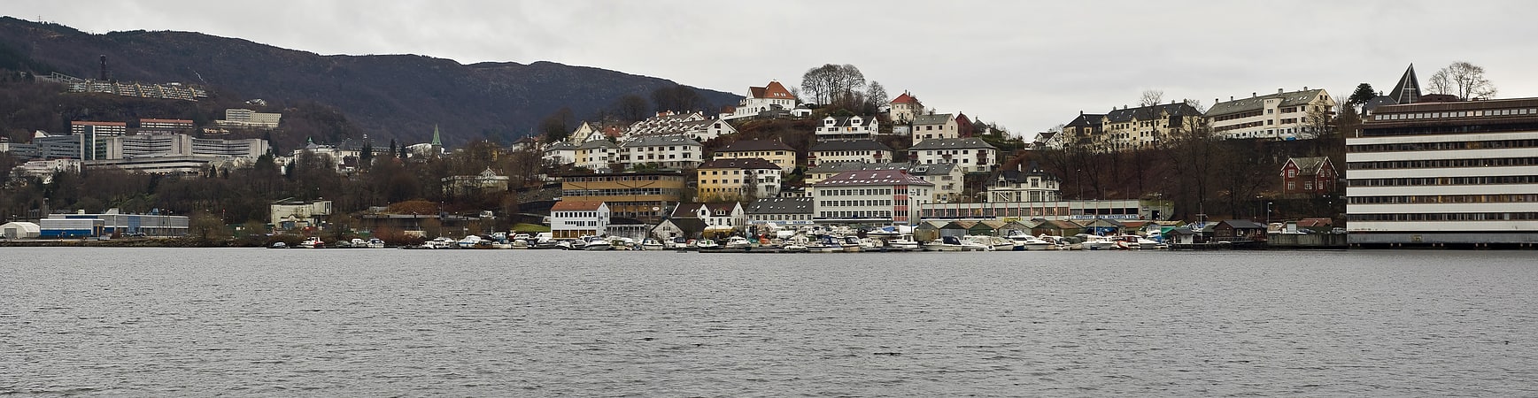
Store Lungegårdsvannet, Bergen
Gallery (1)
Map
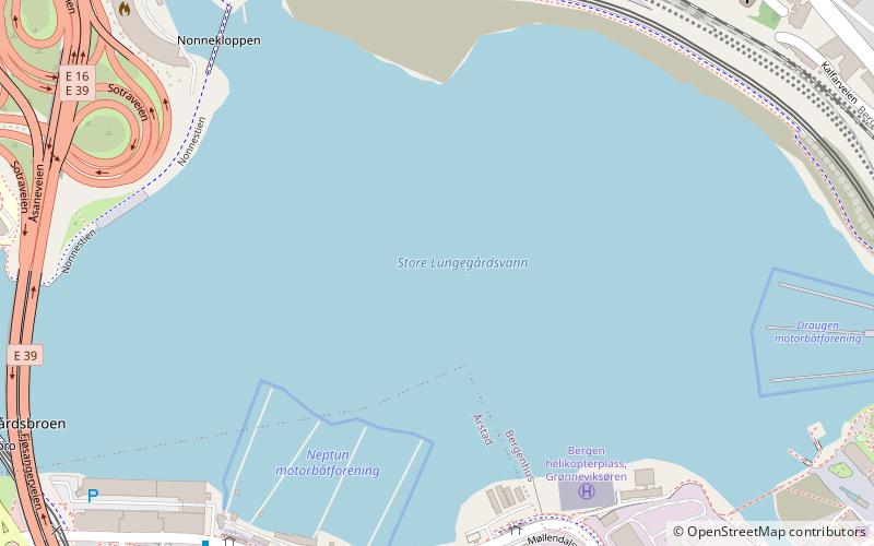
Map
Facts and practical information
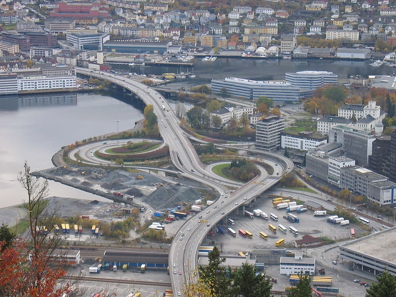
Store Lungegårdsvannet is a bay located in the city and municipality of Bergen in Vestland county, Norway. The bay separates the city centre, located in the borough of Bergenhus, from the southern boroughs of the city, Årstad, Fana and Ytrebygda. The bay is situated at the end of the Puddefjorden. ()
Address
Store LungegårdsvannetBergenhusBergen 5009
ContactAdd
Social media
Add
Getting there by public transportation
Public transportation stops near this location
- Bus
- Tram
- Light rail
- Train
- Ferry
 Bus
Bus
- Calculate routeFlorida 9 min walk
- Calculate routeNygård 11 min walk
- Calculate routeDanmarks plass 12 min walk
- Calculate routeBystasjonen 14 min walk
- Calculate routeFlorida 9 min walk
- Calculate routeNygård 11 min walk
- Calculate routeDanmarks plass 12 min walk
- Calculate routeBystasjonen 14 min walk
- Calculate routeKalfarlien 10 min walk
- Calculate routeKalvedalsveien 10 min walk
- Calculate routeWashingtons vei 12 min walk
- Calculate routeGamle Kalvedalsveien 12 min walk
- Calculate routeBergen 17 min walk
- Calculate routeFløibanen, øvre stasjon 23 min walk
- Calculate routeStrandkaiterminalen båtkai 30 min walk
- Calculate routeStrandkaiterminalen, båt Askøy 31 min walk
- Calculate routeBeffen - Bradbenken 35 min walk
Day trips


Frequently Asked Questions (FAQ)
Which popular attractions are close to Store Lungegårdsvannet?
Nearby attractions include Nygårdstangen, Bergen (8 min walk), Nygård Bridge, Bergen (8 min walk), Kronstad Hovedgård, Bergen (10 min walk), Kalfaret, Bergen (10 min walk).
How to get to Store Lungegårdsvannet by public transport?
The nearest stations to Store Lungegårdsvannet:
Light rail
Tram
Bus
Train
Ferry
Light rail
- Florida • Lines: 1 (9 min walk)
- Nygård • Lines: 1 (11 min walk)
Tram
- Florida • Lines: 1 (9 min walk)
- Nygård • Lines: 1 (11 min walk)
Bus
- Kalfarlien • Lines: 11 (10 min walk)
- Kalvedalsveien • Lines: 11 (10 min walk)
Train
- Bergen (17 min walk)
- Fløibanen, øvre stasjon (23 min walk)
Ferry
- Strandkaiterminalen båtkai (30 min walk)
- Strandkaiterminalen, båt Askøy (31 min walk)