Kristiansund Stadion, Kristiansund
Map
Facts and practical information
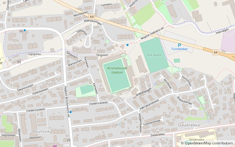
Kristiansund stadion, until 2014 known as Gressbanen is a football stadium located at Karihola in Kristiansund, Norway, and is the home of both Norwegian Eliteserien club Kristiansund Ballklubb and 4. divisjon club Kristiansund Fotballklubb. The stadium has a current capacity of 4,444 spectators. ()
Address
1 Magnar Isaksens veiKristiansund
ContactAdd
Social media
Add
Getting there by public transportation
Public transportation stops near this location
- Bus
- Ferry
 Bus
Bus
- Calculate routeKristiansund trafikkterminal 23 min walk
- Calculate routeKristiansund 27 min walk
- Calculate routeKirklandet 27 min walk
Day trips


Frequently Asked Questions (FAQ)
Which popular attractions are close to Kristiansund Stadion?
Nearby attractions include Atlantic Ocean Tunnel, Kristiansund (5 min walk), Viadukten, Kristiansund (9 min walk), Kirkelandet Church, Kristiansund (19 min walk).
How to get to Kristiansund Stadion by public transport?
The nearest stations to Kristiansund Stadion:
Bus
Ferry
Bus
- Kristiansund trafikkterminal (23 min walk)
Ferry
- Kristiansund • Lines: Gripruta (27 min walk)
- Kirklandet • Lines: Sundbåt (27 min walk)