Mustafa Town, Lahore
Map
Facts and practical information
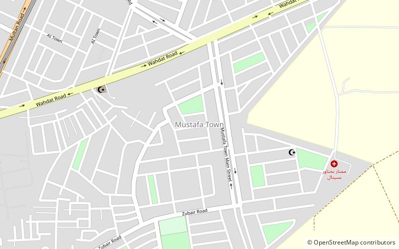
Mustafa Town is a neighbourhood located within union council 109 in Samanabad Tehsil of Lahore, Punjab, Pakistan. It is located on Wahdat Road and Old Multan Road Chungi. The neighbourhood was developed by the Lahore Development Authority. It borders Education Town, Ghani Colony and Mansoorah to the west. ()
Coordinates: 31°29'45"N, 74°16'25"E
Address
Lahore
ContactAdd
Social media
Add
Getting there by public transportation
Public transportation stops near this location
- Metro
 Metro
Metro
- Calculate routeWahdat Road 16 min walk
- Calculate routeAwan Town 16 min walk
Day trips


Frequently Asked Questions (FAQ)
How to get to Mustafa Town by public transport?
The nearest stations to Mustafa Town:
Metro
Metro
- Wahdat Road • Lines: O (16 min walk)
- Awan Town • Lines: O (16 min walk)