Iglesia del Carmen, Panama City
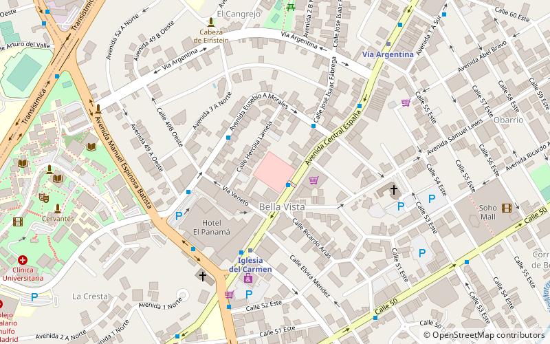
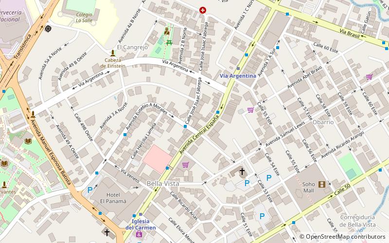
Map
Facts and practical information
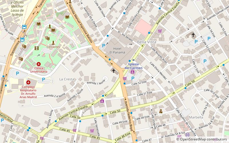
Iglesia del Carmen (address: Avenida Via Espana) is a place located in Panama City (Panamá province) and belongs to the category of church.
It is situated at an altitude of 89 feet, and its geographical coordinates are 8°58'54"N latitude and 79°31'42"W longitude.
Planning a visit to this place, one can easily and conveniently get there by public transportation. Iglesia del Carmen is a short distance from the following public transport stations: Iglesia del Carmen (metro, 3 min walk), Parada de Buses (bus, 14 min walk).
Among other places and attractions worth visiting in the area are: Royal Sonesta Hotel & Casino (nightlife, 6 min walk), Plaza Concordia (shopping, 7 min walk), University of Panama (universities and schools, 10 min walk).
Coordinates: 8°58'54"N, 79°31'42"W
Getting there by public transportation
Public transportation stops near this location
- Metro
- Bus
 Metro
Metro
- Calculate routeIglesia del Carmen 3 min walk
- Calculate routeVía Argentina 17 min walk
- Calculate routeSanto Tomás 18 min walk
- Calculate routeLotería 27 min walk
- Calculate routeParada de Buses 14 min walk
- Calculate routePerejil 21 min walk
- Calculate routeHospital del Niño 24 min walk
- Calculate routeObarrio 25 min walk
Day trips


Frequently Asked Questions (FAQ)
Which popular attractions are close to Iglesia del Carmen?
Nearby attractions include Royal Sonesta Hotel & Casino, Panama City (6 min walk), University of Panama, Panama City (10 min walk), Parque Urracá, Panama City (12 min walk), Cine Universitario, Panama City (13 min walk).
How to get to Iglesia del Carmen by public transport?
The nearest stations to Iglesia del Carmen:
Metro
Bus
Metro
- Iglesia del Carmen • Lines: Línea 1 (3 min walk)
- Vía Argentina • Lines: Línea 1 (17 min walk)
Bus
- Parada de Buses (14 min walk)
- Perejil • Lines: Alcalde Díaz - Via España - Estacion Marañón (21 min walk)