Lacson Avenue, Manila
Map

Gallery

Facts and practical information
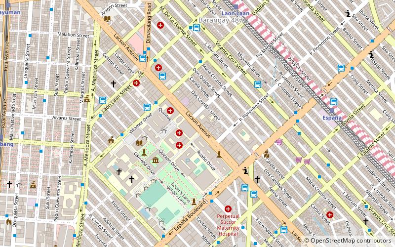
Lacson Avenue is the principal northwest–southeast artery located in Sampaloc district in northern Manila, Philippines. It is a 6-8 lane median divided avenue that runs approximately 2.9 kilometers from Tayuman Street in Santa Cruz to Nagtahan Interchange. It is a component of Circumferential Road 2 of the Manila arterial road network and N140 of the Philippine highway network. ()
Length: 9514 ftCoordinates: 14°36'42"N, 120°59'28"E
Address
SampalocManila
ContactAdd
Social media
Add
Day trips
Lacson Avenue – popular in the area (distance from the attraction)
Nearby attractions include: SM Quiapo, Our Lady of Montserrat Abbey, San Sebastian Church, Recto Avenue.
Frequently Asked Questions (FAQ)
Which popular attractions are close to Lacson Avenue?
Nearby attractions include University of Santo Tomas, Manila (4 min walk), UST Museum of Arts and Sciences, Manila (5 min walk), University of Santo Tomas Main Building, Manila (5 min walk), Benavides Park, Manila (6 min walk).
How to get to Lacson Avenue by public transport?
The nearest stations to Lacson Avenue:
Bus
Train
Light rail
Metro
Ferry
Bus
- Lacson • Lines: 311 (4 min walk)
- Maria de Leon Trans - Sampaloc Terminal (4 min walk)
Train
- Laon Laan (10 min walk)
- España (11 min walk)
Light rail
- Bambang • Lines: 1 (15 min walk)
- Tayuman • Lines: 1 (17 min walk)
Metro
- Recto • Lines: 2 (20 min walk)
- Legarda • Lines: 2 (20 min walk)
Ferry
- Lawton • Lines: Pasig River Ferry (33 min walk)
- Escolta • Lines: Pasig River Ferry (36 min walk)


