Villa Angela Estates, Bacolod
Map
Facts and practical information
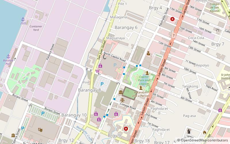
Villa Angela Estates, otherwise called Villa Angela City and formerly called Villa Angela Business District, is a mixed-use residential and commercial estate, located in Brgy. Estefania, Bacolod. Previously separate developments located in the property of the late Don Fernando F. Gonzaga, it was consolidated into a single planned estate managed by the heirs through Fernando F. Gonzaga Estate, Inc. ()
Coordinates: 10°40'36"N, 122°56'60"E
Address
Bacolod
ContactAdd
Social media
Add
Getting there by public transportation
Public transportation stops near this location
- Bus
 Bus
Bus
- Calculate routeOld North Ceres Bus Terminal-now disused 18 min walk
- Calculate routeSouth Ceres Bus Terminal 26 min walk
- Calculate routeBacolod South Bus Terminal 27 min walk
- Calculate routeBacolod Public South Terminal 30 min walk
Day trips


Frequently Asked Questions (FAQ)
Which popular attractions are close to Villa Angela Estates?
Nearby attractions include Negros Occidental Provincial Capitol, Bacolod (2 min walk), Negros Museum, Bacolod (3 min walk), Negros Forests and Ecological Foundation Inc., Bacolod (4 min walk), Dizon-Ramos Museum, Bacolod (11 min walk).
How to get to Villa Angela Estates by public transport?
The nearest stations to Villa Angela Estates:
Bus
Bus
- Old North Ceres Bus Terminal-now disused (18 min walk)
- South Ceres Bus Terminal (26 min walk)