Puerta de Isabel II, Manila
Map
Facts and practical information
The 'Queen Isabel II Statue', is located in front of Puerta Isabel II in Intramuros, Manila, Philippines. It is made of bronze and was funded by donations collected from the city in 1854 and 1855. Ponciano Ponzano, a Spanish sculptor was commissioned to do the work. It was erected amidst festive ceremonies on 14 July 1860 near Teatro Alfonso XII in Arroceros in what is now Plaza Lawton. ()
Coordinates: 14°35'39"N, 120°58'34"E
Address
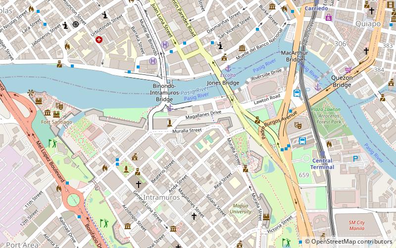
Magallanes DriveIntramurosManila
ContactAdd
Social media
Add
Getting there by public transportation
Public transportation stops near this location
- Metro
- Bus
- Light rail
- Ferry
 Metro
Metro
- Calculate routeEscolta 5 min walk
- Calculate routeLawton 10 min walk
- Calculate routeQuintin Paredes 7 min walk
- Calculate routeYuchengco 7 min walk
- Calculate routeFour Seasons Riviera 7 min walk
- Calculate routeIntramuros 7 min walk
- Calculate routeCentral Terminal 10 min walk
- Calculate routeCarriedo 13 min walk
- Calculate routeDoroteo Jose 23 min walk
- Calculate routeUnited Nations 25 min walk
- Calculate routeRecto 21 min walk
- Calculate routeLegarda 31 min walk
Day trips
Puerta de Isabel II – popular in the area (distance from the attraction)
Nearby attractions include: Fort Santiago, Manila Cathedral, San Agustin Church, SM Quiapo.


Frequently Asked Questions (FAQ)
Which popular attractions are close to Puerta de Isabel II?
Nearby attractions include Colegio de San Juan de Letran, Manila (1 min walk), Plaza de España, Manila (3 min walk), Jones Bridge, Manila (4 min walk), Colegio de Santa Rosa, Manila (4 min walk).
How to get to Puerta de Isabel II by public transport?
The nearest stations to Puerta de Isabel II:
Ferry
Bus
Light rail
Metro
Ferry
- Escolta • Lines: Pasig River Ferry (5 min walk)
- Lawton • Lines: Pasig River Ferry (10 min walk)
Bus
- Quintin Paredes • Lines: T330 (7 min walk)
- Yuchengco • Lines: T330 (7 min walk)
Light rail
- Central Terminal • Lines: 1 (10 min walk)
- Carriedo • Lines: 1 (13 min walk)
Metro
- Recto • Lines: 2 (21 min walk)
- Legarda • Lines: 2 (31 min walk)