Góra Ziuty
#389 among destinations in Poland
![Góra Ziuty location map](https://tzmedia.b-cdn.net/media/images/static-maps/pl/50_7304_16_1137.jpg)
Facts and practical information
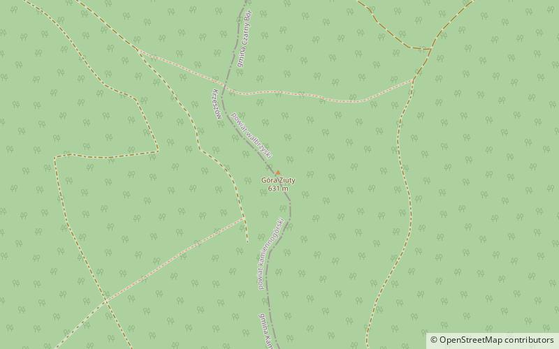
Góra Ziuty - the highest peak of Krzeszowskie Wzgórza, within Kotlina Kamiennogórska in Central Sudetes. ()
Lower SilesianPoland
Góra Ziuty – popular in the area (distance from the attraction)
Nearby attractions include: Church of the Graceful, Krzeszów Abbey, Góra Świętej Anny, Czerep.
2 miWChurchChurch of the Graceful
50 min walk • The Church of Grace in Poland is a unique example of sacred architecture, bearing witness to the rich history and culture of the region. This temple, although perhaps not as recognizable as other European cathedrals, serves as an important place of worship and a local...
1.9 miWMonasteryKrzeszów Abbey
50 min walk • Krzeszów Abbey, nestled in the serene landscape of Lower Silesia in Poland, stands as a testament to the country's rich monastic heritage. Established in the 13th century, this Baroque masterpiece is a former Cistercian monastery, now known as one of the most precious...
1 miWNature, Natural attraction, MountainGóra Świętej Anny
25 min walk • Mount Saint Anne – peak 593 m a.s.l. is a mountain in Poland. located in north-west part of Krzeszowskie Wzgórza, near Kamiengorian Valley, in Central Sudeten.
1.9 miSENature, Natural attraction, MountainCzerep
49 min walk • Czerep – a hill in the southern part of the Krzeszowskie Wzgórza, within Kotlina Kamiennogórska, in Central Sudetes.
5 miNW50°46'48"N • 16°1'48"EPodziemna Trasa Turystyczna "Projekt Arado", Kamienna Góra
128 min walk • Historical place, Museum
5.1 miNW50°47'2"N • 16°1'60"EUrząd Miasta w Kamiennej Górze, Kamienna Góra
131 min walk • Specialty museum, Museum, City hall
4.9 miNWChurchKościół Matki Bożej Różańcowej, Kamienna Góra
125 min walk • Church of Our Lady of the Rosary in Kamienna Góra - a former Evangelical Grace Church, after World War II and the displacement of the German population, taken over by the state and given to the Catholic Church.
5 miNWCemeteryDawny Cmentarz Żydowski, Kamienna Góra
128 min walk • Old Jewish cemetery in Kamienna Góra - a historic Jewish necropolis located on Katowicka Street near the municipal cemetery. The cemetery was established in the first half of 19th century. It is rectangular in shape and has area of 450 m².
5.4 miNENature, Natural attraction, MountainChełmiec
139 min walk • Chełmiec - a mountain peak 850 m above sea level, part of the Chełmiec Massif, which is part of the Wałbrzyskie Mountains, rising directly over the vicinity of Wałbrzych. It is the highest point within the administrative borders of Szczawno-Zdrój.
5 miNW 4 miENature, Natural attraction, MountainDzikowiec
104 min walk • Dzikowiec Wielki or Dzikowiec is a peak in southwestern Poland, in the Central Sudetes, in the Dzikowiec and Lesista Wielka massif, in the northwestern part of the Kamienne Mountains.