Silesian Lowlands, Wrocław
Map
Facts and practical information
Silesian Lowlands are lowlands located in Silesia, Poland in Central Europe. A small part is located in the Czech Republic. It is part of the Central European Plain. Silesian Lowlands is a physical-geographical macroregion. It is the warmest region in Poland. ()
Address
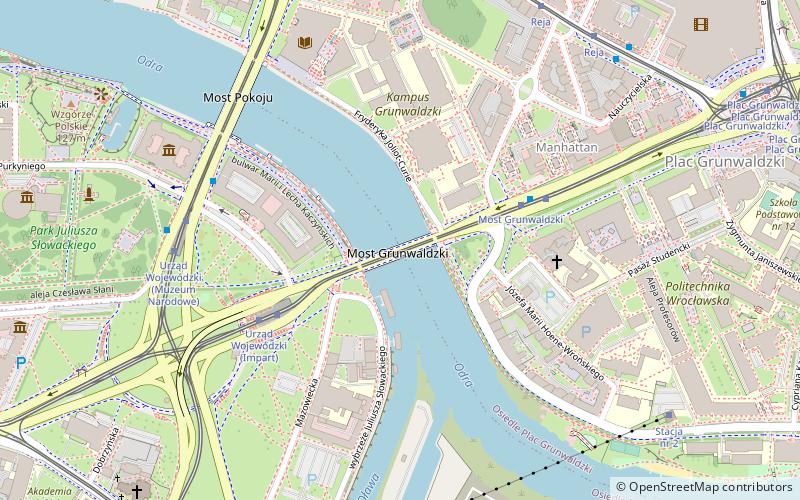
Śródmieście (Plac Grunwaldzki)Wrocław
ContactAdd
Social media
Add
Getting there by public transportation
Public transportation stops near this location
- Bus
- Tram
- Train
 Bus
Bus
- Calculate routeMost Grunwaldzki 4 min walk
- Calculate routeUrząd Wojewódzki 5 min walk
- Calculate routeReja 7 min walk
- Calculate routeKatedra 8 min walk
- Calculate routeMost Grunwaldzki 4 min walk
- Calculate routeUrząd Wojewódzki 6 min walk
- Calculate routeWrocław Główny 27 min walk
- Calculate routeWrocław Nadodrze 36 min walk
Day trips


Frequently Asked Questions (FAQ)
Which popular attractions are close to Silesian Lowlands?
Nearby attractions include Grunwald Bridge, Wrocław (1 min walk), National Museum, Wrocław (6 min walk), Peace Bridge, Wrocław (6 min walk), Oławski Bridge, Wrocław (7 min walk).
How to get to Silesian Lowlands by public transport?
The nearest stations to Silesian Lowlands:
Bus
Tram
Train
Bus
- Most Grunwaldzki • Lines: 145, 146, 149, 240, 241, D (4 min walk)
- Urząd Wojewódzki • Lines: 145, 146, 149, 240, 241, 246, 250, 253, 255, A, D, N (5 min walk)
Tram
- Most Grunwaldzki • Lines: 0L, 0P, 16, 33, 4 (4 min walk)
- Urząd Wojewódzki • Lines: 0L, 0P, 10, 16, 2, 33, 4 (6 min walk)
Train
- Wrocław Główny (27 min walk)
- Wrocław Nadodrze (36 min walk)