Serra da Estrela Natural Park

Gallery (4)
Map

Map
Gallery
Facts and practical information
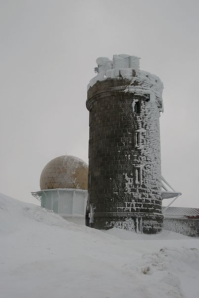
Serra da Estrela Natural Park is situated in the largest mountain range in Portugal - the Serra da Estrela, and is the source of the rivers Mondego, Zêzere, and Alva. The park is the largest natural conservation area in Portugal and occupies about 1,000 km². More than half of its area is located above an altitude of 700 m. At 1,993 m it contains the highest peak in Continental Portugal and a ski resort. ()
Local name: Parque Natural da Serra da Estrela Area: 344157.33 mi²Elevation: 6529 ft a.s.l.Coordinates: 40°19'19"N, 7°36'46"W
Location
Castelo Branco
ContactAdd
Social media
Add
Day trips