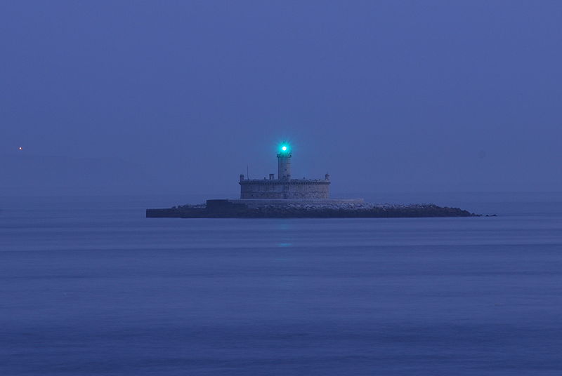
Bugio Lighthouse, Oeiras

Gallery (2)
Map
Map
Gallery
Facts and practical information
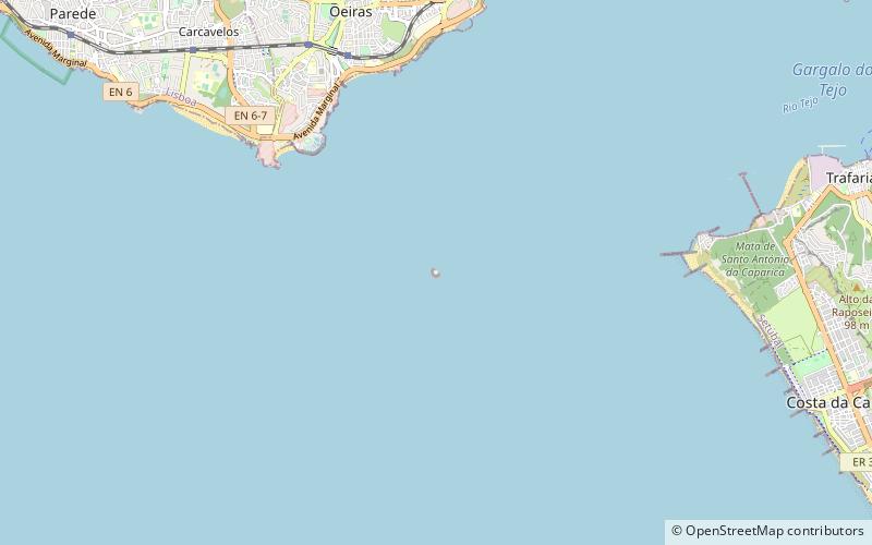
The Bugio Lighthouse is situated on an island in the estuary of the River Tagus on the Fort of São Lourenço do Bugio, about ten kilometres west of Lisbon. It falls under the municipality of Oeiras in Lisbon District. ()
Address
Oeiras
ContactAdd
Social media
Add
Day trips