Cerro del Diablo, Ponce
#31 among attractions in Ponce


Facts and practical information
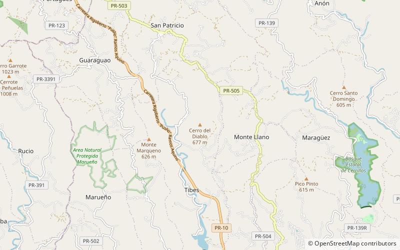
Cerro del Diablo is a mountain in the municipality of Ponce, Puerto Rico, located north-northwest of the city of Ponce. The 2,234-foot high hill sits at the foothills of the Cordillera Central and is located in Barrio Tibes. ()
Ponce Puerto Rico
Cerro del Diablo – popular in the area (distance from the attraction)
Nearby attractions include: Centro Ceremonial Indígena de Tibes, Cerro de Punta, Museo Hacienda Buena Vista, Hacienda Buena Vista.
 Pre-Columbian archaeological site
Centro Ceremonial Indígena de Tibes, Ponce
111 min walk • Steeped in the rich history of Puerto Rico's indigenous peoples, the Centro Ceremonial Indígena de Tibes in Ponce stands as a crucial archaeological site and museum that brings to life the pre-Columbian cultures of the Caribbean.
 Natural attraction, Mountain, Park
Cerro de Punta, Ponce
142 min walk • Cerro de Punta stands as the highest peak in Puerto Rico, located in the city of Ponce, within the Cordillera Central mountain range. Rising to an altitude of 1,338 meters (4,390 feet), this mountain provides a breathtaking vantage point over the island's lush...
 Museum, History museum, Colonial architecture
Museo Hacienda Buena Vista, Ponce
47 min walk • Nestled in the lush, verdant valleys of Ponce, Puerto Rico, the Museo Hacienda Buena Vista stands as a testament to the island's rich agricultural past. This carefully restored 19th-century coffee plantation offers visitors a glimpse into the bygone era of Puerto Rican...
 Museum, History museum, Hispanic colonial architecture
Hacienda Buena Vista, Ponce
49 min walk • Nestled in the lush, verdant hills near Ponce, Puerto Rico, Hacienda Buena Vista stands as a testament to the island's rich agricultural past. This restored 19th-century coffee plantation is now a living museum, offering visitors a glimpse into the historical...
 Locality
Marueño
72 min walk • Marueño is one of the 31 barrios of the municipality of Ponce, Puerto Rico. Along with Anón, Coto Laurel, Guaraguao, Quebrada Limón, Real, and San Patricio, and the coastal barrios of Canas and Capitanejo, Marueño is one of the municipality's nine bordering barrios. Marueño borders the municipality of Peñuelas.
 Park
ParkParque Luis A. "Wito" Morales, Ponce
111 min walk • Nestled in the heart of Ponce, Puerto Rico, Parque Luis A. "Wito" Morales serves as a verdant oasis amidst the bustling city life. This serene park is a favorite among locals and visitors alike, providing a tranquil space for relaxation, recreation, and family...
 Nature, Natural attraction, Mountain
Monte Jayuya, Ponce
151 min walk • Monte Jayuya is the second highest peak of Puerto Rico measuring 1,296 meters above sea level. The mountain is located in the Cordillera Central, on the border between the municipalities of Jayuya and Ponce.
 Sculpture, Public art
Letras de Ponce, Ponce
175 min walk • The Letras de Ponce is a famous landmark in Barrio Sabanetas in Ponce, Puerto Rico, located southbound on PR-52 at the intersection with PR-10.
 Nature, Natural attraction, Mountain
Cerro Maravilla, Ponce
161 min walk • Cerro Maravilla is Puerto Rico's fourth highest peak at 1,205 meters. It is located on the northern edge Barrio Anón in Ponce, close to the border with the municipality Jayuya, and is part of the Cordillera Central.
 Nature, Natural attraction, Forest
Cerrillos State Forest, Ponce
97 min walk • Cerrillos State Forest is one of the 21 state forests in Puerto Rico. It is located in barrio Maragüez, in the municipality of Ponce, and covers 200 cuerdas of valleys and mountains in the foothills of the Cordillera Central mountain range.
 Dam
DamPortugués Dam, Ponce
73 min walk • The Portugués Dam is a roller-compacted concrete thick arch dam on the Portugués River, three miles northwest of the city Ponce, in Barrio Tibes, Ponce, Puerto Rico. Construction on the dam began in April 2008, soon after the U.S.
