Trek Zone

Al-Ahly Stadium, Doha
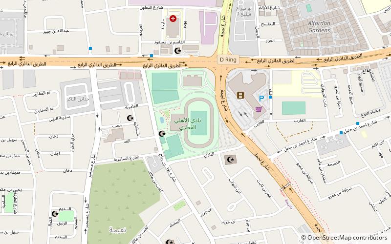
#57 among attractions in Doha

Sport venue, Sport, Arenas and stadiums
Al-Ahly Stadium location map
Map

Facts and practical information

Local name: ملعب حمد بن خليفة Coordinates: 25°15'7"N, 51°32'7"E
Address

نعيجة (n yjt)Doha Qatar

ContactAdd
Social media
Day trips

Al-Ahly Stadium – popular in the area (distance from the attraction)

Nearby attractions include: Museum of Islamic Art, Emiri Diwan, Msheireb Museums, National Museum of Qatar.

  • museum of islamic art doha3 miN
  • emiri diwan doha location map
    2.8 miN
  • msheireb museums doha2.4 miN
  • qatar national museum doha2.6 miN
  • souq waqif doha2.4 miN
  • church of our lady of the rosary doha2.8 miS
  • fanar qatar islamic cultural center doha2.6 miN
  • doha corniche2.7 miN
  • al koot fort doha2.4 miN
  • 7 sculpture doha3.2 miN
  • qatar national library doha2.1 miN

Frequently Asked Questions (FAQ)

How to get to Al-Ahly Stadium by public transport?

The nearest stations to Al-Ahly Stadium:

Bus
  • Al Hilal Bus Station • Lines: 10 (30 min walk)

Where to next? Visit ad dawhah Ad Dawhah region page or discover the top tourist attractions in Qatar.