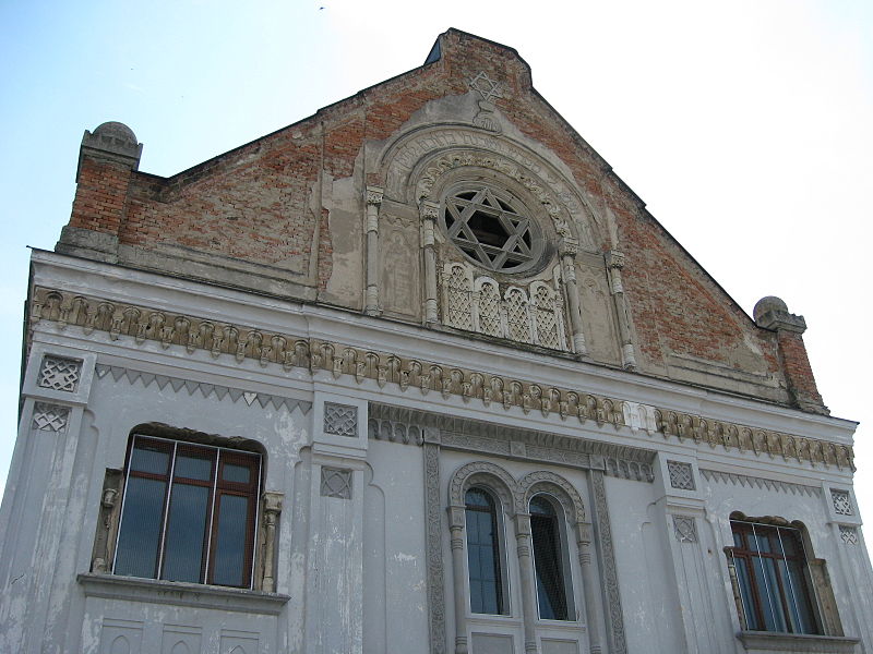
Mestské Múzeum Šurany - Synagóga

Gallery (2)
Map
Map
Gallery
Facts and practical information
Mestské Múzeum Šurany - Synagóga is a place located in Slovakia and belongs to the category of museum.
It is situated at an altitude of 404 feet, and its geographical coordinates are 48°5'17"N latitude and 18°11'19"E longitude.
Among other places and attractions worth visiting in the area are: Nitriansky Hrádok (archaeological site, 39 min walk).
Coordinates: 48°5'17"N, 18°11'19"E
Location
Nitriansky
ContactAdd
Social media
Add
Day trips
Mestské Múzeum Šurany - Synagóga – popular in the area (distance from the attraction)
Nearby attractions include: Nitriansky Hrádok.
