Sella Nevea
#94 among destinations in Slovenia
![Sella Nevea location map](https://tzmedia.b-cdn.net/media/images/static-maps/si/46_3628_13_4865.jpg)
![Sella Nevea](https://tzmedia.b-cdn.net/media/images/si/place/gallery/medium/0d1c69dcbc81cbbdcfcbdb53d50f8ff0.jpg)
Facts and practical information
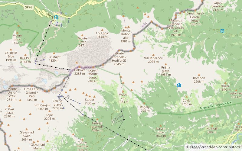
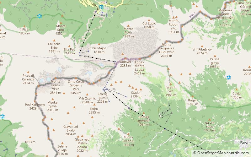
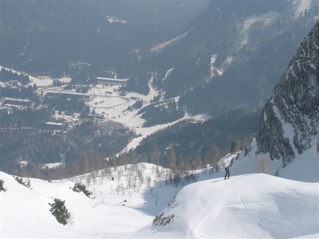
Sella Nevea, at an altitude of 1,195 m, is a high mountain pass in the Julian Alps, in the Friuli-Venezia Giulia region of northeast Italy. Sella Nevea also lends its name to a frazione of the Chiusaforte municipality and the nearby Kanin-Sella Nevea Ski Resort. ()
Sella Nevea plan & book
Unleash the traveler in you — discover the cheapest flight deals, find the perfect hotel or hostel nearby, and search for the best car rental prices. Travel at your own pace to discover new places and enjoy your journey.
Sella Nevea – popular in the area (distance from the attraction)
Nearby attractions include: Boka Waterfall, Hotel Kanin, Kluže Fortress, Čehi 2 cave.
3.1 miSNature, Natural attraction, WaterfallBoka Waterfall, Srpenica
79 min walk • Boka is a waterfall in the western part of Slovenia, near the Soča River. It begins at a karst spring and has two stages, of which the first is 106 meters high and 18 meters wide, and the second is 33 meters high.
3.7 miSEWinter sport, Ski areaHotel Kanin, Bovec
94 min walk • Kanin-Sella Nevea is a joint Slovenian-Italian ski resort located on the slopes of Mt Kanin and Sella Nevea Pass at the Slovenian-Italian border. The nearest locality is Bovec about an hour away from the Slovene capital Ljubljana. On the Italian side, Tarvisio and Chiusaforte are the closest settlements.
4.9 miEHistorical place, MuseumKluže Fortress, Triglav National Park
126 min walk • The Kluže Fortress is a fort near the town of Bovec in northwestern Slovenia. The original fortress was built in 1472 near Bovec on the road between Cave del Predil and Carinthia. Its likely original purpose was defence of Friuli against the Turks.
1.2 miECaveČehi 2 cave, Triglav National Park
30 min walk • Čehi 2 on Rombonski podi is the deepest sinkhole in Slovenia and the 13th deepest cave in the world. It is 1505 meters deep and 5536 meters long. There is a siphon at the bottom. The entrance is located 2033 meters above the sea level. The cave was discovered in 1991.
5.6 miENature, Natural attraction, MountainSvinjak, Triglav National Park
143 min walk • Mount Svinjak is a 1,653-meter mountain in northwestern Slovenia in the Julian Alps. It stands east-northeast of Bovec. The name of the mountain is derived from *Svitnjak 'shining one' because it is illuminated by the rising sun when viewed from Bovec.
5.9 miNEScenic, alpine pass known for bicyclingPredil Pass, Triglav National Park
150 min walk • The Predil Pass or Predel Pass is a high mountain pass on the border between Italy and Slovenia.
3.5 miSE46°20'16"N • 13°33'4"ESrnica park pustolovskih doživetij - Adventure park Srnica, Bovec
90 min walk • Adventure park, Hiking and camping tours, Tours
2 miSWNature, Natural attraction, CaveVrtiglavica
52 min walk • Vrtiglavica, also Vrtoglavica, is a karst shaft on the Kanin Plateau, part of the Kanin Mountains, Western Julian Alps, on the Slovene side of the border between Slovenia and Italy. It has the deepest single vertical drop in the world, at 603 metres.
6.9 miSWNature, Natural attraction, MountainPrestreljenik
175 min walk • Mount Prestreljenik is a 2,499-meter mountain in the western range of the Julian Alps, in the Tolmin region of Slovenia on the Italian–Slovenian border. It is the second-highest peak in the central part of the Kanin group. Prestreljenik is known for the Window, an erosion-arch feature located on its western ridge.
3.3 miENature, MountainRombon, Triglav National Park
83 min walk • Rombon or Veliki vrh is a 2208 m high peak north of Bovec. Rombon is a rocky peak, in the Kanin group, which falls steeply into the valley of the Možnica stream on the north side, and from the south it is accessible along the light...
2.8 miSNatural attraction, WaterfallBoka Waterfall
72 min walk • Boka is a waterfall in the western part of Slovenia, near the Soča River. It begins at a karst spring and has two stages, of which the first is 106 meters high and 18 meters wide, and the second is 33 meters high.