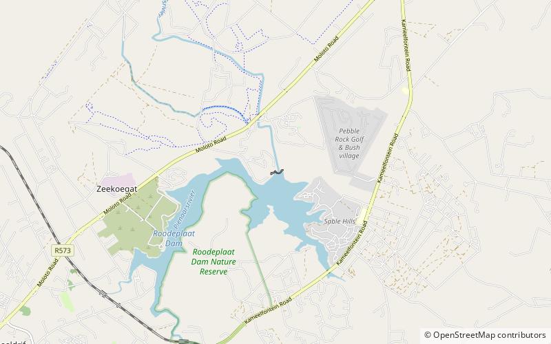
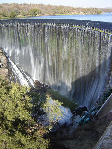
Roodeplaat Dam

Gallery (3)
Map
Map
Gallery
Facts and practical information
Roodeplaat Dam is a concrete arch dam situated in South Africa on the Pienaars River, a tributary of the Crocodile River, which flows northwards into the Limpopo River. The dam is a warm monomictic impoundment with stable thermal stratification during the summer. ()
Local name: RoodeplaatdamOpened: 1959 (67 years ago)Length: 1152 ftHeight: 180 ftCoordinates: 25°37'15"S, 28°22'17"E
Location
Gauteng
ContactAdd
Social media
Add
Day trips
Roodeplaat Dam – popular in the area (distance from the attraction)
Nearby attractions include: Roodeplaat Nature Reserve.
