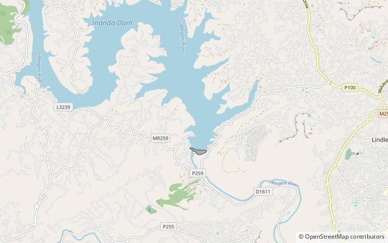
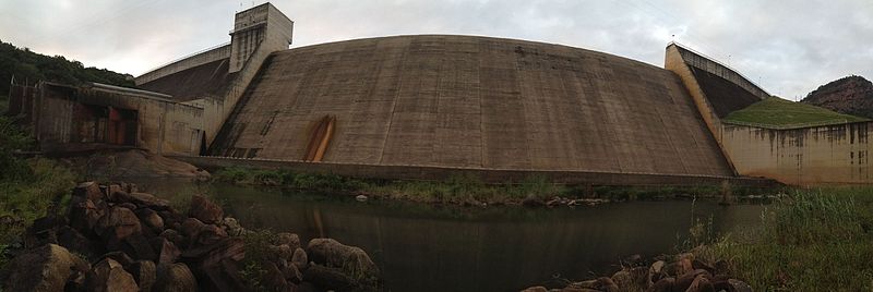
Inanda Dam

Gallery (3)
Map
Map
Gallery
Facts and practical information
Inanda Dam is an earth-fill type dam located on the Mgeni River, near Inanda, KwaZulu-Natal, South Africa. It was established in 1989 and its primary purpose is to serve for domestic and industrial use. ()
Local name: Inandadam Opened: 1989 (37 years ago)Length: 1952 ftHeight: 213 ftCoordinates: 29°42'1"S, 30°52'1"E
Location
KwaZulu-Natal
ContactAdd
Social media
Add
Day trips