Trek Zone

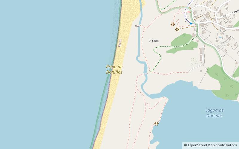
Praia de Doniños, Ferrol

#4 among attractions in Ferrol

Beach, Surf spot
Praia de Doniños

Facts and practical information

Praia de Doniños is a place located in Ferrol (Galicia autonomous community) and belongs to the category of beach, surf spot.

It is situated at an altitude of 23 feet, and its geographical coordinates are 43°29'42"N latitude and 8°19'8"W longitude.

Among other places and attractions worth visiting in the area are: Castelo de San Felipe (forts and castles, 72 min walk), Monastery of Santa Catalina de Montefaro, Ares (historical place, 92 min walk), Estadio Municipal da Malata (arenas and stadiums, 102 min walk).

Coordinates: 43°29'42"N, 8°19'8"W
Address

Ferrol Spain

ContactAdd
Social media
Add

Ferrol plan & book

Unleash the traveler in you — discover the cheapest flight deals, find the perfect hotel or hostel nearby, and search for the best car rental prices. Travel at your own pace to discover new places and enjoy your journey.

Day trips

Praia de Doniños – popular in the area (distance from the attraction)

Nearby attractions include: Cabo Prior Lighthouse, Spain's National Exhibition of Ship Building, Monastery of Santa Catalina de Montefaro, Ferrol Cathedral.

  • cabo prior lighthouse ferrol5 miN
  • spains national exhibition of ship building ferrol location map
    4.5 miE
  • monastery of santa catalina de montefaro ares3.6 miSE
  • ferrol cathedral4.3 miE
  • mugardos ferrol4.2 miSE
  • castelo de san felipe ferrol2.8 miSE
  • praza vella ferrol4 miE
  • baluarte de canido ferrol4.1 miE
  • estadio municipal da malata ferrol4 miE
  • casino ferrolano4.3 miE

Where to next? Visit galicia Galicia region page or discover the top tourist attractions in Spain.