Calle de Hortaleza, Madrid
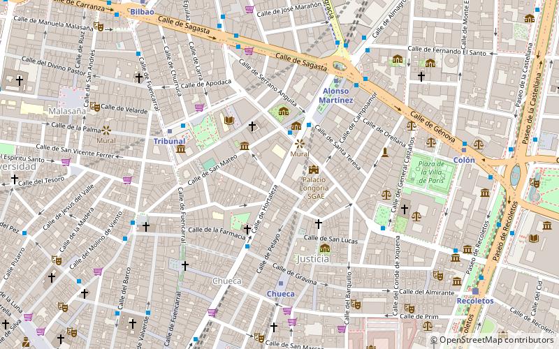
Map
Facts and practical information
Address
Centro Madrid (Justicia)Madrid
ContactAdd
Social media
Add
Getting there by public transportation
Public transportation stops near this location
- Metro
- Bus
- Train
 Metro
Metro
- Calculate routeMejía Lequerica - Hortaleza 2 min walk
- Calculate routePza. de Santa Bárbara 3 min walk
- Calculate routeHortaleza - Gravina 4 min walk
- Calculate routeBarceló - Tribunal 5 min walk
- Calculate routeChueca 5 min walk
- Calculate routeAlonso Martínez 5 min walk
- Calculate routeTribunal 5 min walk
- Calculate routeColón 8 min walk
- Calculate routeRecoletos 10 min walk
- Calculate routeSol 15 min walk
- Calculate routePríncipe Pío 30 min walk
- Calculate routeMoncloa 31 min walk
Maps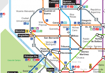 Metro
Metro
MetroDay trips


Frequently Asked Questions (FAQ)
Which popular attractions are close to Calle de Hortaleza?
Nearby attractions include Palacio Longoria, Madrid (2 min walk), Museo del Romanticismo, Madrid (2 min walk), Anglican Cathedral of the Redeemer, Madrid (3 min walk), Justicia, Madrid (3 min walk).
How to get to Calle de Hortaleza by public transport?
The nearest stations to Calle de Hortaleza:
Bus
Metro
Train
Bus
- Mejía Lequerica - Hortaleza • Lines: 37 (2 min walk)
- Pza. de Santa Bárbara • Lines: 3 (3 min walk)
Metro
- Chueca • Lines: L5 (5 min walk)
- Alonso Martínez • Lines: L10, L4, L5 (5 min walk)
Train
- Recoletos (10 min walk)
- Sol (15 min walk)