Stenhagenbiblioteket, Uppsala

Gallery (1)
Map
Map
Facts and practical information
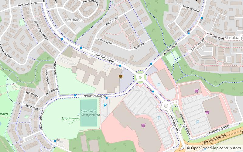
Stenhagenbiblioteket (address: Herrhagsvägen 8) is a place located in Uppsala (Uppsala county) and belongs to the category of library.
It is situated at an altitude of 135 feet, and its geographical coordinates are 59°51'2"N latitude and 17°33'30"E longitude.
Planning a visit to this place, one can easily and conveniently get there by public transportation. Stenhagenbiblioteket is a short distance from the following public transport stations: Stenhagens centrum (bus, 2 min walk).
Among other places and attractions worth visiting in the area are: Flogsta (neighbourhood, 29 min walk), Läby kyrka (church, 32 min walk), Bror Hjorths Hus (museum, 55 min walk).
Coordinates: 59°51'2"N, 17°33'30"E
Address
Herrhagsvägen 8Uppsala
ContactAdd
Social media
Add
Getting there by public transportation
Public transportation stops near this location
- Bus
 Bus
Bus
- Calculate routeStenhagens centrum 2 min walk
- Calculate routeStenhagens IP 3 min walk
- Calculate routeKiselvägen 4 min walk
- Calculate routeStenröset 6 min walk
Day trips


Frequently Asked Questions (FAQ)
How to get to Stenhagenbiblioteket by public transport?
The nearest stations to Stenhagenbiblioteket:
Bus
Bus
- Stenhagens centrum • Lines: 12, 5 (2 min walk)
- Stenhagens IP • Lines: 12 (3 min walk)