Johanneshovsbron, Södertörn
Map

Map

Facts and practical information
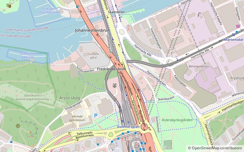
Johanneshovsbron is a 756 metres long and 17,9 metres wide road bridge in central Stockholm, Sweden. Overpassing two older bridges, Skansbron and Skanstullsbron, and one newer bridge, Fredriksdalsbron, it connects Södermalm and the tunnel passing under it, Söderledstunneln, to Johanneshov, the district immediately south of the historical city centre, and national road 73, leading out of the city. ()
Address
Enskede - Årsta - Vantör (Årsta)Södertörn
ContactAdd
Social media
Add
Day trips
Johanneshovsbron – popular in the area (distance from the attraction)
Nearby attractions include: Avicii Arena, Tele2 Arena, Eriksdalsbadet, Sofia Church.
Frequently Asked Questions (FAQ)
Which popular attractions are close to Johanneshovsbron?
Nearby attractions include Fredriksdalsbron, Stockholm (2 min walk), Skansbron, Stockholm (4 min walk), Gullmarsplan, Stockholm (5 min walk), Skanstullsbron, Stockholm (5 min walk).
How to get to Johanneshovsbron by public transport?
The nearest stations to Johanneshovsbron:
Tram
Metro
Bus
Ferry
Train
Tram
- Gullmarsplan • Lines: 30 (3 min walk)
- Mårtensdal • Lines: 30 (8 min walk)
Metro
- Gullmarsplan • Lines: 17, 18, 19 (3 min walk)
- Globen • Lines: 19 (13 min walk)
Bus
- Gullmarsplan • Lines: 144, 160, 164, 168, 188, 193, 194, 195, 4, 791, 794, 796, 801, 802, 804, 805, 806, 807, 808, 809, 810, 814, 816, 822, 823, 873, 875, 890, 892, 893, 94 (5 min walk)
- Tullgårdsparken • Lines: 57 (8 min walk)
Ferry
- Lumabryggan • Lines: Sjöstadstrafiken (19 min walk)
- Barnängsbryggan • Lines: Sjöstadstrafiken (20 min walk)
Train
- Stockholms södra (28 min walk)
- Henriksdal (32 min walk)


