Yushan South Peak, Yushan Mountain

Facts and practical information
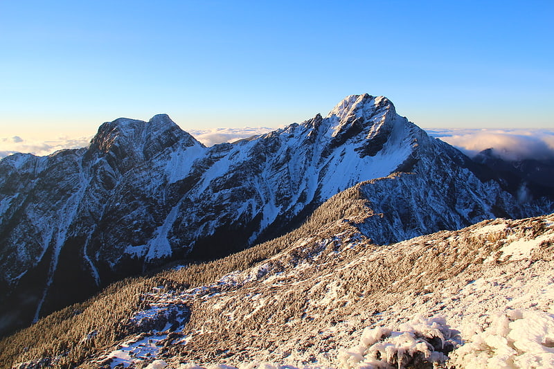
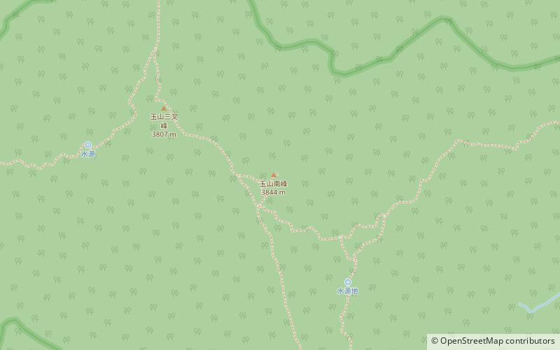
It is located 2.6 kilometers south of the main peak of Mount Yu and within the boundaries of Mount Yu National Park, with an elevation of 3,844 meters. During the Japanese rule, it was called Nanshan and Xingao Nanshan, and its administrative area belongs to Meishanli, Taoyuan District, Kaohsiung City. "When you look south from the main peak, you can see the winding ridge of..... with its sharp peaks and elegant corners, resembling a dragon with its head held high and looking forward to its flight": Taiwanese mountaineer Xing Tianzheng called it "Tianlong Peak". The exact location of the peak on the ridge has not been unanimously determined in the past century. From the "Fortress Map of Taiwan" of 1898-1904, the "Topographic Map of Taiwan" of 1924, and the "Topographic Map of Taiwan" of 1924, to the "Topographic Map of the Far Eastern U.S. Army Bureau of Cartography" and the "Topographic Map of the United Nations", "Nanshan" was drawn on the location of the present-day Yushan Sanjiaofeng; and the "Topographic Map of Taiwan" of 1907, the "New High Mountain Map" issued by the Taiwan Mountain Association in 1922, and the journal "Taiwan The 1907 Topographic Map of the Five Thousand Centuries and the 1922 New Takayama Map issued by the Taiwan Mountain Association and the journal "Taiwan Mountains", as well as the climbing of Nanshan described in Dr. Tadao Kano's book "Mountains, Clouds, and People", which recorded the alpine climbing in Taiwan during the college days, Nanshan was drawn at the present location of the recognized South Peak. After 2013, the basic topographic map of the National Land Survey and Mapping Center On some maps, there are notes such as "Yu Shan Sanjiao Feng" and "Closed Curve Feng". In recent years, the National Park and the hiking community have located the summit of the South Jade Mountain peak at the highest point on the east branch of the South Jade Mountain ridge toward the Deer Mountain ridge, and have placed iron signs. The public trail to the summit of the South Peak bypasses the north side of the rocky slope and does not pass through the Closing Curve Peak and the ridge; other information suggests that the Closing Curve Peak is the present-day South Peak of Yushan.
Yushan Mountain