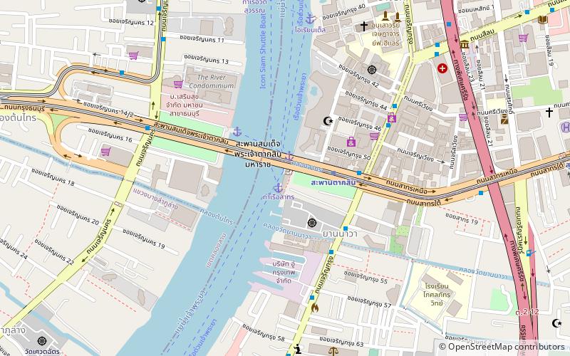
Sathorn Pier, Bangkok

Gallery (1)
Map
Map
Facts and practical information
Coordinates: 13°43'7"N, 100°30'46"E
Address
ลุมพินี (สาทร)Bangkok
ContactAdd
Social media
Add
Getting there by public transportation
Public transportation stops near this location
- Metro
- Bus
- Ferry
 Metro
Metro
- Calculate routeSathorn 1 min walk
- Calculate routeOriental 9 min walk
- Calculate routeSi Phraya 18 min walk
- Calculate routeWat Worachanyawas 19 min walk
- Calculate routeSaphan Taksin 3 min walk
- Calculate routeCharoen Nakhon 16 min walk
- Calculate routeSurasak 16 min walk
- Calculate routeKrung Thon Buri 17 min walk
- Calculate routeBts กรุงธนบุรี 16 min walk
- Calculate routeOpposite Post Office Watprayakai 19 min walk
- Calculate routeCharoen Krung 81 21 min walk
- Calculate routeWat Worachanyawas 22 min walk
Day trips


Frequently Asked Questions (FAQ)
Which popular attractions are close to Sathorn Pier?
Nearby attractions include Taksin Bridge, Bangkok (4 min walk), Yan Nawa Subdistrict, Bangkok (5 min walk), Chaloem Phan 53 Bridge, Bangkok (5 min walk), Sathorn Unique Tower, Bangkok (5 min walk).
How to get to Sathorn Pier by public transport?
The nearest stations to Sathorn Pier:
Ferry
Metro
Bus
Ferry
- Sathorn • Lines: เรือด่วนพิเศษธงส้ม, เรือด่วนพิเศษธงเขียว, เรือด่วนพิเศษธงเหลือง, เรือท่องเที่ยวเจ้าพระยา, เรือประจำทาง (ไม่มีธง) (1 min walk)
- Oriental (9 min walk)
Metro
- Saphan Taksin • Lines: BTS Silom (3 min walk)
- Charoen Nakhon • Lines: BTS Gold Line (16 min walk)
Bus
- Bts กรุงธนบุรี • Lines: 3 (16 min walk)
- Opposite Post Office Watprayakai • Lines: 1, 15, 75 (19 min walk)