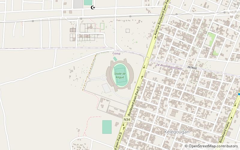
Stade de Kégué, Lomé
Map
Facts and practical information
Stade de Kégué is a multi-use stadium in Lomé, Togo. It is currently used mostly for football matches. The stadium holds 40,000 people and opened in 2000. It was designed by Chinese architect Yang Zhou. The stadium was the main host of the 2007 African U-17 Championship, in March 2007. ()
Alternative names: Opened: 12 January 2000 (26 years ago)Capacity: 40 thous.Coordinates: 6°12'8"N, 1°14'23"E
Address
Lomé
ContactAdd
Social media
Add
Getting there by public transportation
Public transportation stops near this location
- Bus
 Bus
Bus
- Calculate routeRond point Tinga 16 min walk
- Calculate routeSagbovile 17 min walk
- Calculate routeVoie de Contournement 19 min walk
- Calculate routeMaison de la Sage Femme 20 min walk
Day trips


Frequently Asked Questions (FAQ)
How to get to Stade de Kégué by public transport?
The nearest stations to Stade de Kégué:
Bus
Bus
- Rond point Tinga • Lines: L4 (16 min walk)
- Sagbovile • Lines: L4 (17 min walk)