Kayakapı, Ürgüp

Gallery (2)
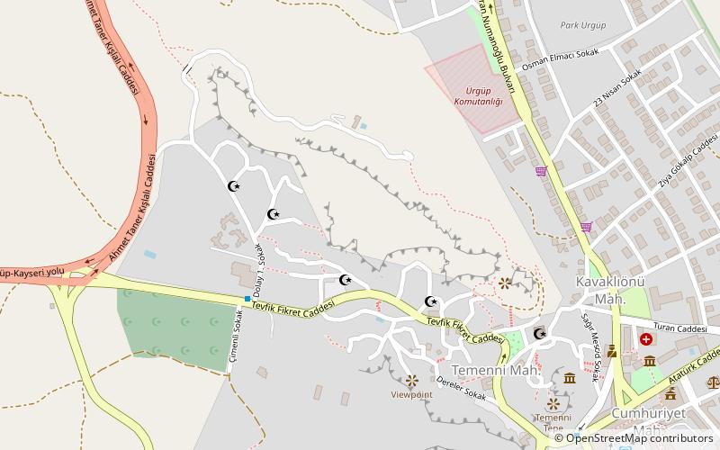
Map
Map
Gallery
Facts and practical information
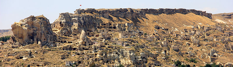
The Kayakapi neighbourhood of Ürgüp, Turkey is a historical area located on the northeastern slope of a hill known as Esbelli. It features many examples of vernacular and monumental architecture, including the House of Saint John the Russian. Abandoned after the 1980s, the semi-ruins and natural landscape of Kayakapi are now being developed for tourism. ()
Coordinates: 38°38'5"N, 34°54'21"E
Address
Ürgüp
ContactAdd
Social media
Add
Day trips


Frequently Asked Questions (FAQ)
Which popular attractions are close to Kayakapı?
Nearby attractions include Kayakapı Premium Caves - Cappadocia, Ürgüp (4 min walk), Ürgüp Müzesi, Ürgüp (11 min walk).