Batyieva Hora, Kyiv
Map

Map

Facts and practical information
Batyieva Hora is a former village, and now a historical neighbourhood of Kyiv, the capital of Ukraine. It is located on the right bank of the Dnieper, on the side of the hill above the river Lybid. Burial grounds of Zarubintsy culture dated in the 2nd-4th century AD were discovered in Batyieva Hora. ()
Address
Соломєнский (Нова Заьудова)Kyiv
ContactAdd
Social media
Add
Day trips
Batyieva Hora – popular in the area (distance from the attraction)
Nearby attractions include: Gulliver Building, Palace of Sports, St Volodymyr's Cathedral, A.V. Fomin Botanical Garden.
Frequently Asked Questions (FAQ)
Which popular attractions are close to Batyieva Hora?
Nearby attractions include Kuchmyn Yar Street, Kyiv (12 min walk), Mykola Lysenko House-Museum, Kyiv (17 min walk), The Historical Locomotives and Cars Exhibition, Kyiv (20 min walk), National University of Food Technologies, Kyiv (21 min walk).
How to get to Batyieva Hora by public transport?
The nearest stations to Batyieva Hora:
Train
Trolleybus
Bus
Metro
Tram
Train
- Kiev-Tovarnyi (9 min walk)
- Protasiv Yar (14 min walk)
Trolleybus
- вул. Докучаєвська • Lines: 40к, Тр40 (11 min walk)
- Залізничний масив • Lines: 3 (11 min walk)
Bus
- Центр зайнятості • Lines: 825 (13 min walk)
- вул. Паньківська • Lines: 825, А69 (14 min walk)
Metro
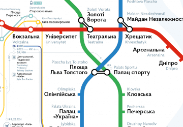
- Vokzalna • Lines: M1 (21 min walk)
- Olimpiiska • Lines: M2 (24 min walk)
Tram
- вул. Старовокзальна • Lines: 15, 18 (25 min walk)
- площа Перемоги • Lines: 15, 18 (29 min walk)

 Metro
Metro


