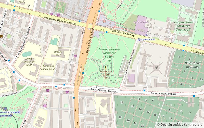
St. Cyril's Monastery, Kyiv
Map
Facts and practical information
St. Cyril's Monastery is a medieval monastery in Kyiv, the capital of Ukraine. The monastery contains the famous St. Cyril's Church, an important specimen of Kyivan Rus architecture of the 12th century, and combining elements of the 17th and 19th centuries. However, being largely Ukrainian Baroque on the outside, the church retains its original Kyivan Rus interior. ()
Getting there by public transportation
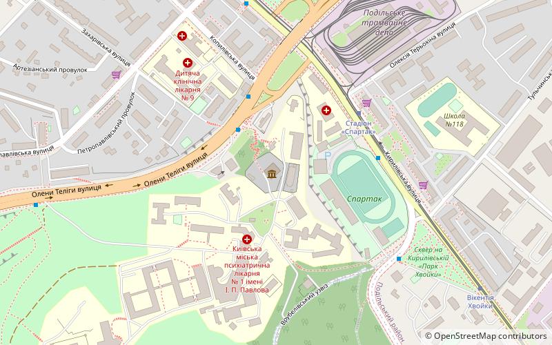
Public transportation stops near this location
- Metro
- Bus
- Trolleybus
- Tram
- Train
 Metro
Metro
- Calculate routeСтадіон Спартак 4 min walk
- Calculate routeКуренівський парк 8 min walk
- Calculate routeVikentiya Khvoyky 10 min walk
- Calculate routeпр. Степана Бандери 12 min walk
- Calculate routeпров. Лютневий 12 min walk
- Calculate routeВулиця Нагірна 18 min walk
- Calculate routeПошта 86 18 min walk
- Calculate routeStop 14 min walk
- Calculate routeстанція Зеніт 18 min walk
- Calculate routeЗавод Промзв'язок 29 min walk
- Calculate routeVyshhorodska 29 min walk
- Calculate routeDorohozhychi 29 min walk
- Calculate routePochayna 30 min walk
Maps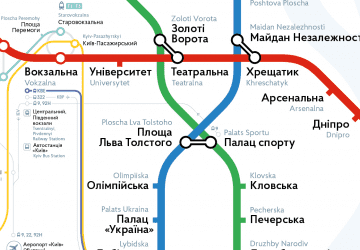 Metro
Metro
MetroDay trips


Frequently Asked Questions (FAQ)
When is St. Cyril's Monastery open?
St. Cyril's Monastery is open:
- Monday 10 am - 5:30 pm
- Tuesday 10 am - 5:30 pm
- Wednesday 10 am - 5:30 pm
- Thursday 10 am - 4:30 pm
- Friday closed
- Saturday 10 am - 5:30 pm
- Sunday 10 am - 5:30 pm
How to get to St. Cyril's Monastery by public transport?
The nearest stations to St. Cyril's Monastery:
Tram
Bus
Trolleybus
Train
Metro
Tram
- Стадіон Спартак • Lines: 11, 12, 19 (4 min walk)
- Куренівський парк • Lines: 11, 12, 19 (8 min walk)
Bus
- пров. Лютневий • Lines: Мт227 (12 min walk)
- Вулиця Нагірна • Lines: А31 (18 min walk)
Trolleybus
- Stop • Lines: 18 (14 min walk)
- станція Зеніт • Lines: Тр31 (18 min walk)
Train
- Vyshhorodska (29 min walk)
Metro
- Dorohozhychi • Lines: M3 (29 min walk)
- Pochayna • Lines: M2 (30 min walk)