Castell Dinas, Brecon Beacons
#49 among attractions in Brecon Beacons

Facts and practical information
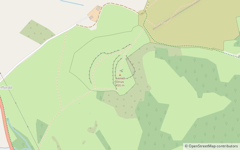
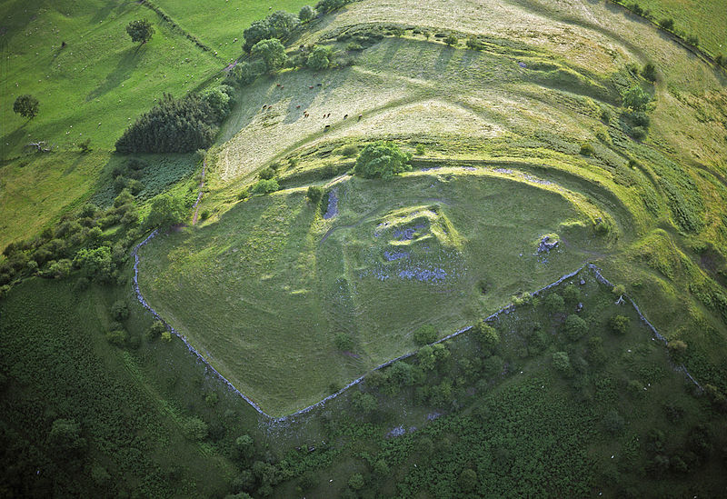
Castell Dinas is a hillfort and castle in southern Powys, Wales. At 450 m it has the highest castle in England and Wales. It is positioned to defend the Rhiangoll pass between Talgarth and Crickhowell. ()
Brecon Beacons United Kingdom
Brecon Beacons plan & book
Unleash the traveler in you — discover the cheapest flight deals, find the perfect hotel or hostel nearby, and search for the best car rental prices. Travel at your own pace to discover new places and enjoy your journey.
Castell Dinas – popular in the area (distance from the attraction)
Nearby attractions include: Llangorse Lake, Llanthony Abbey, Mynydd Troed, Twmpa.
 Fishing and boating in a historic setting
Llangorse Lake, Brecon Beacons
93 min walk • Llangorse Lake is the largest natural lake in Mid and South Wales, and is situated in the Brecon Beacons National Park, near the town of Brecon and the village of Llangors.
 Monastery
Llanthony Abbey, Brecon Beacons
117 min walk • Llanthony Abbey is a former Anglican monastic institution founded in 1869 by Joseph Leycester Lyne, in the Welsh village of Capel-y-ffin, a few miles from the medieval Llanthony Priory. It survived until 1908, after which it was the home of artist Eric Gill. It is now holiday accommodation.
 Nature, Natural attraction, Mountain
Mynydd Troed, Brecon Beacons
25 min walk • Mynydd Troed is a hill in the Black Mountains of the Brecon Beacons National Park in Powys, south Wales. Its name literally translates to "Foot Mountain," based how it appears when viewed from the Allt Mawr ridge.
 Nature, Natural attraction, Mountain
Twmpa, Brecon Beacons
108 min walk • Twmpa or Lord Hereford's Knob is a mountain in south-east Wales, forming a part of the great northwest scarp of the Black Mountains. It lies 1.86 miles west of the border with England, and around 4.34 miles south of Hay-on-Wye. To the northeast lies the Gospel Pass through which runs a minor road between Hay and the Llanthony Valley.
 Nature, Natural attraction, Mountain
Pen Allt-mawr, Brecon Beacons
102 min walk • Pen Allt-mawr is a 719 metres high subsidiary summit of Waun Fach and the third highest peak in the Black Mountains in south-eastern Wales.
 Nature, Natural attraction, Mountain
Waun Fach, Brecon Beacons
58 min walk • Waun Fach is, with a summit height of 811 metres, the highest mountain in the Black Mountains in south-eastern Wales. It is one of the three Marilyns over 600 m that make up the range, the others being Black Mountain and Mynydd Troed.
 Archaeological site
Grwyne Fawr Reservoir, Brecon Beacons
84 min walk • The Grwyne Fawr Reservoir is located in the valley of the river Grwyne Fawr in the Brecon Beacons National Park, Wales. Completed in 1928, it has the capacity to hold 400,000,000 imperial gallons.
 Nature, Natural attraction, Natural feature
Black Mountains, Brecon Beacons
108 min walk • The Black Mountains are a group of hills spread across parts of Powys and Monmouthshire in southeast Wales, and extending across the England–Wales border into Herefordshire.
 Nature, Natural attraction, Hill
Hatterrall Ridge
145 min walk • The Hatterrall Ridge is a ridge in the Black Mountains forming the border between Powys and Monmouthshire in Wales and Herefordshire in England.
 Nature, Natural attraction, Mountain
Mynydd Llangorse, Brecon Beacons
63 min walk • Mynydd Llangorse is a hill on the western edge of the Black Mountains in the Brecon Beacons National Park in Powys, south Wales. It lies two miles east of Llangors and its lake and 5 miles south of Talgarth. Its summit at 515m overtops the location 600m to the south at which a trig point is sited by 9m.
 Nature, Natural attraction, Waterfall
Pwll y wrach, Talgarth
44 min walk • Pwll y wrach or Pwll-y-wrach is a feature on the River Ennig near Talgarth in south Powys, Wales. The river plunges in two separate streams over a lip of hard rock into a pool scoured in the softer mudstones of the underlying Raglan Mudstone formation.


