Falls of Leny, Callander
#3 among attractions in Callander
![Falls of Leny location map](https://tzmedia.b-cdn.net/media/images/static-maps/gb/56_251_-4_27315.jpg)
Facts and practical information
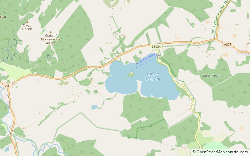
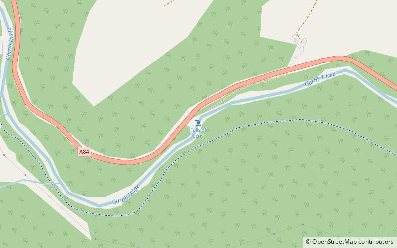
The Falls of Leny are a series of waterfalls in the Trossachs of Scotland on the course of the Garbh Uisge, otherwise known as the River Leny, where the river crosses the Highland Boundary Fault. The falls are located near the Pass of Leny, just north-west of Callander. ()
Callander United Kingdom
Callander plan & book
Unleash the traveler in you — discover the cheapest flight deals, find the perfect hotel or hostel nearby, and search for the best car rental prices. Travel at your own pace to discover new places and enjoy your journey.
Falls of Leny – popular in the area (distance from the attraction)
Nearby attractions include: Inchmahome Priory, Bracklinn Falls, Ben Ledi, Stùc a' Chroin.
5.2 miS13th-century island monastery ruinsInchmahome Priory, Inchmahome
134 min walk • Inchmahome Priory is situated on Inchmahome, the largest of three islands in the centre of the Lake of Menteith, close to Aberfoyle, Scotland. The name "Inchmahome" comes from the Gaelic Innis MoCholmaig, meaning island of St Colmaig.
3.3 miENature, Natural attraction, WaterfallBracklinn Falls, Callander
84 min walk • The Bracklinn Falls are a series of waterfalls north-east of Callander, Scotland on the course of the Keltie Water, where the river crosses the Highland Boundary Fault. Over recent years there have been a number of tragic incidents at the falls.
2 miWNature, Natural attraction, MountainBen Ledi, Loch Lomond and The Trossachs National Park
50 min walk • Ben Ledi is a mountain in Stirling, Scotland. It is 879 metres high, and is therefore classified as a Corbett. It lies about six kilometres northwest of Callander, near the village of Kilmahog.
5.6 miNNature, Natural attraction, MountainStùc a' Chroin, Loch Lomond and The Trossachs National Park
143 min walk • Stùc a' Chroin is a mountain located in the southern part of the Highlands in Scotland. It lies to the south of Ben Vorlich, which is itself bounded to the north by Loch Earn, and to the west by Loch Lubnaig.
5.4 miSForts and castlesTalla Castle, Loch Lomond and The Trossachs National Park
138 min walk • Talla Castle, also known as Inch Talla or Inchtalla Castle, was a 15th-century castle on Inchtalla upon Lake of Menteith, Scotland. The castle was built by Malise Graham, Earl of Mentieth starting in 1427.
4.4 miNMountainBeinn Each, Loch Lomond and The Trossachs National Park
112 min walk • Beinn Each is a mountain in the southern Grampian Mountains of Scotland. It is located in Stirlingshire, north of the town of Callander.
5.4 miSAreaInchtalla, Loch Lomond and The Trossachs National Park
138 min walk • Inchtalla or Inch Talla is an island in the Loch or Lake of Menteith in central Scotland. Its name derives from the Gaelic words innis and "talla". The entire island is dominated by Talla Castle, which appears to have been built in the 18th century. It was erected on the site of an earlier building that dates from 1428.
5.3 miSNature, Natural attraction, LakeLake of Menteith, Loch Lomond and The Trossachs National Park
137 min walk • Lake of Menteith, also known as Loch Inchmahome, is a loch in Scotland located on the Carse of Stirling.
2.9 miNNature, Natural attraction, LakeLoch Lubnaig, Loch Lomond and The Trossachs National Park
74 min walk • Loch Lubnaig is a small freshwater loch near Callander in the Stirling council area, Scottish Highlands. It lies in the former county of Perthshire. It is part of the Loch Lomond and The Trossachs National Park. The loch nestles in the space between Ben Ledi and Ben Vorlich.
2.4 miE 4.1 miSWNature, Natural attraction, LakeLoch Drunkie, Loch Lomond and The Trossachs National Park
106 min walk • Loch Drunkie is a small freshwater loch in the Trossachs near Aberfoyle in the Stirling council area, Scotland.