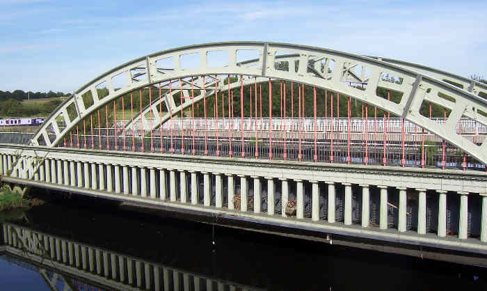
The Stanley Ferry, Wakefield
Map

Gallery

Facts and practical information
Stanley Ferry Aqueduct was built between 1836 and 1839 to take the Aire and Calder Navigation over the River Calder in West Yorkshire, England. It is one of the earliest through arch bridges in the world and is considered to be the longest span aqueduct executed in cast iron. ()
Coordinates: 53°42'6"N, 1°27'48"W
Address
Ferry Lane, StanleyStanleyWakefield
ContactAdd
Social media
Add
Day trips
The Stanley Ferry – popular in the area (distance from the attraction)
Nearby attractions include: Trinity Walk, The Hepworth Wakefield, Wakefield Cathedral, The Ridings Centre.
Frequently Asked Questions (FAQ)
How to get to The Stanley Ferry by public transport?
The nearest stations to The Stanley Ferry:
Bus
Bus
- Aberford Road Ferry Lane • Lines: 444, 446 (16 min walk)
- Wakefield Eastern Relief Road Aberford Road • Lines: 444, 446 (19 min walk)


