Hurleston Junction
#1362 among destinations in the United Kingdom


Facts and practical information
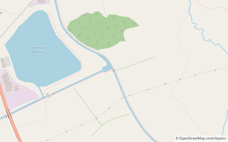
Hurleston Junction is the name of the canal junction where the Llangollen Canal terminates and meets the Shropshire Union Canal main line at Hurleston, Cheshire, England. ()
EnglandUnited Kingdom
Hurleston Junction – popular in the area (distance from the attraction)
Nearby attractions include: Beeston Castle, Gresty Road, 46 High Street, St Boniface's Church.
 Forts and castles, Historical place
Beeston Castle
154 min walk • Beeston Castle, crowning a rocky crag with sweeping views over the Cheshire countryside, is a fortress steeped in history and legend. This medieval castle, now in ruins, was built in the 1220s by Ranulf de Blondeville, 6th Earl of Chester, on the site of an earlier...
 Arenas and stadiums, Sport, Football
Gresty Road, Crewe
131 min walk • Gresty Road or the Alexandra Stadium, currently known as the Mornflake Stadium for sponsorship reasons, is a football stadium in Crewe, Cheshire, England. The home ground of Crewe Alexandra, it has an all-seated capacity of 10,153.
 Shopping, Bookshop
46 High Street, Nantwich
62 min walk • 46 High Street is a timber-framed, black-and-white Elizabethan merchant's house in Nantwich, Cheshire, England, located near the town square at the corner of High Street and Castle Street.
 Church
St Boniface's Church
101 min walk • St Boniface's Church stands prominently in the village of Bunbury, Cheshire, England. It is recorded in the National Heritage List for England as a designated Grade I listed building. The church dates mainly from the 14th century.
 Canal
CanalBarbridge Junction
34 min walk • Barbridge Junction is the name of the canal junction located at Barbridge, Cheshire, where the Shropshire Union Canal Middlewich Branch terminates and meets the Shropshire Union Canal main line.
 Museum, Historical place
Bunbury Mill
96 min walk • Bunbury Mill is a watermill located to the east of the village of Bunbury, Cheshire, England. After being at risk of demolition, it has been restored as a working museum. The structure is designated by Historic England as a Grade II listed building.
 Church, Gothic architecture, Gothic Revival architecture
St Mary's Church, Nantwich
37 min walk • St Mary's Church is an active Anglican parish church located in Monk's Lane, Acton, a village to the west of Nantwich, Cheshire, England. Since 1967 it has been designated a Grade I listed building. A church has been present on this site since before the time of the Domesday Survey.
 Museum, History museum
Dorfold Hall
47 min walk • Dorfold Hall is a Grade I listed Jacobean mansion in Acton, Cheshire, England, considered by Nikolaus Pevsner to be one of the two finest Jacobean houses in the county. The present owners are the Roundells.
 Night club, Forts and castles
Nantwich Castle, Nantwich
61 min walk • Nantwich Castle was a Norman castle in Nantwich, Cheshire, England, built before 1180 to guard a ford across the River Weaver. The castle is first documented in 1288. It was last recorded in 1462, and was in ruins by 1485.
 Church
St Margaret's Church
130 min walk • St Margaret's Church overlooks the village green of Wrenbury, Cheshire, England. The church is recorded in the National Heritage List for England as a designated Grade II* listed building. It is an active Anglican parish church in the diocese of Chester, the archdeaconry of Macclesfield and the deanery of Nantwich.
 Hiking, Hiking trail
Bishop Bennet Way
152 min walk • The Bishop Bennet Way is a bridleway in south west Cheshire, England. It is named after William Bennet, Bishop of Cork and Ross and subsequently Bishop of Cloyne, who carried out detailed surveys of Roman roads including those between Deva and Mediolanum.
