Kirkdale sundial
#4154 among destinations in the United Kingdom
Facts and practical information
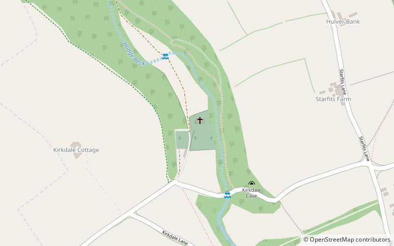
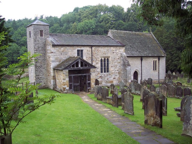
The Saxon sundial at St Gregory's Minster, Kirkdale in North Yorkshire, near Kirkbymoorside, is an ancient canonical sundial which dates to the mid 11th century. ()
EnglandUnited Kingdom
Kirkdale sundial – popular in the area (distance from the attraction)
Nearby attractions include: Helmsley Open Air Swimming Pool, Ampleforth Abbey, Church of All Saints, Nunnington Hall.
4.2 miW54°15'4"N • 1°3'51"WHelmsley Open Air Swimming Pool, North York Moors
107 min walk • Watersports, Theme park, Amusement park
6.5 miSWMonastery, Sacred and religious sitesAmpleforth Abbey
165 min walk • Ampleforth Abbey is a monastery of Benedictine Monks a mile to the east of Ampleforth, North Yorkshire, England, part of the English Benedictine Congregation.
4.2 miWHistorical place, Sacred and religious sites, ChurchChurch of All Saints, Helmsley
107 min walk • The Church of All Saints is an Anglican parish church serving the town of Helmsley in North Yorkshire, England. It is located between the north-west corner of the market square, and Castlegate, on the B1257 road north of Helmsley Castle.
4 miSHistory museum, Museum, Art museumNunnington Hall, Pickering
103 min walk • Nunnington Hall is a country house situated in the English county of North Yorkshire. The river Rye, which gives its name to the local area, Ryedale, runs past the house, flowing away from the village of Nunnington. A stone bridge over the river separates the grounds of the house from the village.
4.2 miWHiking, Hiking trailEbor Way, North York Moors
108 min walk • The Ebor Way is a 70-mile long-distance footpath from Helmsley, North Yorkshire to Ilkley, West Yorkshire, England. It takes its name from Eboracum, the Roman name for York.
3.3 miNE54°18'8"N • 0°54'55"WRyedale Folk Museum, Hutton-le-Hole
84 min walk • History museum, Art gallery, Shopping
6.7 miSWChurchHoly Cross
170 min walk • Holy Cross Church is a parish church which serves the village and parish of Gilling East in North Yorkshire, England. The parish contains the villages of Gilling, Cawton, and Grimston. The church is dedicated to the Holy Cross, although it has been referred to as either the church of Saint Mary or the church of Saint Helena in the past.
~40 ftNEChurchSt Gregory's Minster
1 min walk • St Gregory's Minster is an Anglo-Saxon church with a rare sundial, in Kirkdale near Kirkbymoorside, Vale of Pickering, North Yorkshire, England. It is a Grade I listed building.
2.8 miSWChurchSt Saviour's Church
72 min walk • St Saviour's Church, Harome is a Grade II listed parish church in the Church of England in Harome, North Yorkshire.
5.5 miSWChurchSaint Oswald's
140 min walk • The Church of Saint Oswald, King and Martyr is an Anglican church serving the village and parish of Oswaldkirk, North Yorkshire, England. It is located along the main road passing through the village, 1.5 miles east of Ampleforth Abbey.
5.1 miSChurchStonegrave Minster
130 min walk • Stonegrave Minster, also known as the Holy Trinity parish church, is a church in Stonegrave, Ryedale, North Yorkshire, England. It is known for the heraldry adorned upon some of the tombs and monuments.