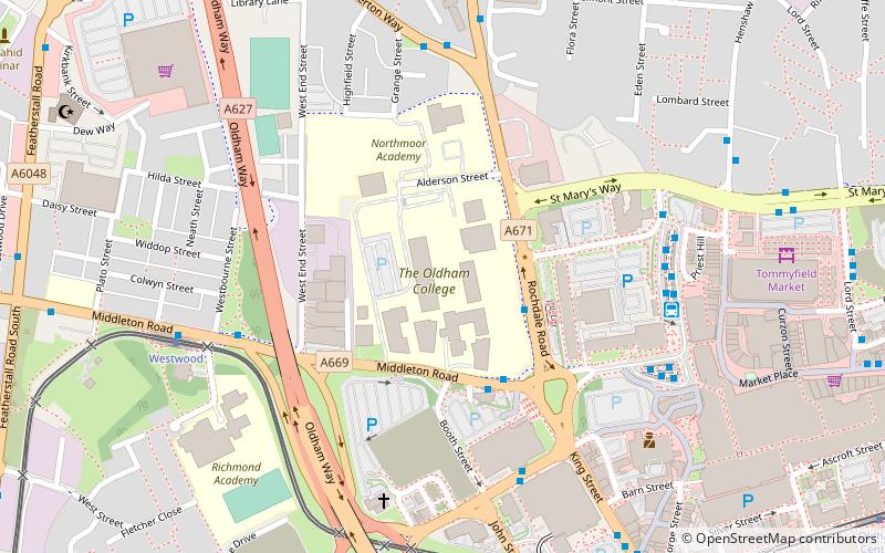
Oldham College, Oldham
Map
Facts and practical information
Oldham College, is a further education college based in Oldham, Greater Manchester, England. ()
Coordinates: 53°32'35"N, 2°7'14"W
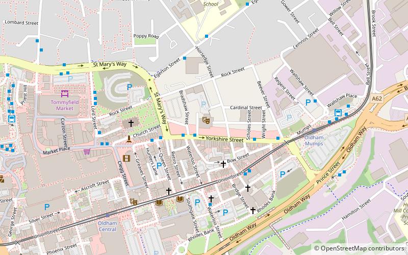
Getting there by public transportation
Public transportation stops near this location
- Bus
- Tram
 Bus
Bus
- Calculate routeOldham Central Bus Station 5 min walk
- Calculate routeOldham West Street Bus Station 5 min walk
- Calculate routeOldham Mumps Interchange 19 min walk
- Calculate routeWestwood 6 min walk
- Calculate routeOldham King Street 8 min walk
- Calculate routeOldham Central 11 min walk
- Calculate routeOldham Mumps 18 min walk
Day trips


Frequently Asked Questions (FAQ)
Which popular attractions are close to Oldham College?
Nearby attractions include Oldham Civic Centre, Oldham (5 min walk), St Patrick's, Oldham (8 min walk), Oldham Sixth Form College, Oldham (9 min walk), Manchester Street Veterinary Surgery, Oldham (10 min walk).
How to get to Oldham College by public transport?
The nearest stations to Oldham College:
Bus
Tram
Bus
- Oldham Central Bus Station (5 min walk)
- Oldham West Street Bus Station (5 min walk)
Tram
- Westwood • Lines: EDid, Roch, Shaw (6 min walk)
- Oldham King Street • Lines: EDid, Roch, Shaw (8 min walk)