Witton-le-Wear

Facts and practical information
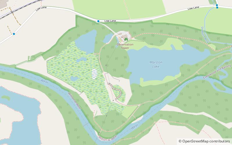
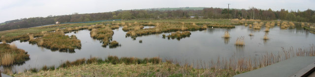
Witton-le-Wear is a Site of Special Scientific Interest located in the valley of the River Wear, immediately east of the village of Witton-le-Wear in County Durham, England. ()
Best Ways to Experience the Park
Wildlife
AnimalsSee what popular animal species you can meet in this location.
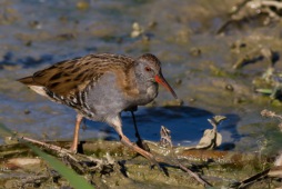
Water rail
The water rail is a captivating bird belonging to the rail family, found across Europe, Asia, and North Africa. These birds flourish in wetlands with abundant vegetation, which they expertly navigate thanks to their slender bodies.
Birds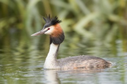
Great crested grebe
The great crested grebe is a captivating water bird renowned for its elaborate courtship dance. It is the largest member of the grebe family in the Old World and is an adept swimmer and diver, effortlessly catching fish underwater.
Birds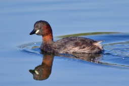
Little grebe
The little grebe, also known as the dabchick, is a delightful small water bird from the grebe family. Measuring just 23 to 29 cm in length, it is the smallest member of the grebe family in Europe. Its genus name originates from Ancient Greek words meaning "fast"...
Birds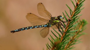
Southern hawker
The southern hawker, also known as the blue hawker, is a striking dragonfly species from the hawker family. You can spot these beauties throughout Europe, from Scotland and southern Scandinavia down to Italy and the northern Balkans.
Insects