Greater Glasgow, Glasgow
Facts and practical information
Greater Glasgow is an urban settlement in Scotland consisting of all localities which are physically attached to the city of Glasgow, forming with it a single contiguous urban area. It does not relate to municipal government boundaries and its territorial extent is defined by the General Register Office for Scotland, which determines settlements in Scotland for census and statistical purposes. Greater Glasgow had a population of 1,199,629 at the time of the 2001 UK Census making it the largest urban area in Scotland and the fifth-largest in the United Kingdom. However, the population estimate for the Greater Glasgow 'settlement' in mid-2016 was 985,290 – the reduced figure explained by the removal of the Motherwell & Wishaw, Coatbridge & Airdrie and Hamilton settlement areas east of the city due to small gaps between the populated postcodes. The 'new towns' of Cumbernauld and East Kilbride were never included in these figures despite their close ties to Glasgow due to having a clear geographical separation from the city. In the 2020 figures, the Greater Glasgow population had risen to just over 1 million. ()
- Metro
- Bus
- Train
 Metro
Metro
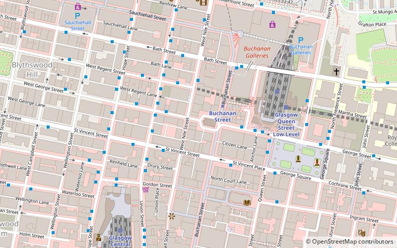
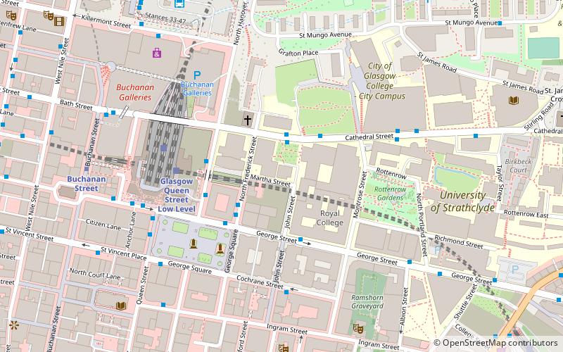
- Calculate routeBuchanan Street 2 min walk
- Calculate routeSt Enoch 8 min walk
- Calculate routeCowcaddens 12 min walk
- Calculate routeBridge Street 19 min walk
- Calculate routeRenfield Street / West George Street 2 min walk
- Calculate routeRenfield Street / West Regent Lane 3 min walk
- Calculate routeSt. Vincent Place / Buchanan Street 3 min walk
- Calculate routeGlasgow Queen Street 4 min walk
- Calculate routeGlasgow Queen Street Low Level 4 min walk
- Calculate routeGlasgow Central 6 min walk
- Calculate routeGlasgow Central Low Level 8 min walk


Frequently Asked Questions (FAQ)
Which popular attractions are close to Greater Glasgow?
How to get to Greater Glasgow by public transport?
Metro
- Buchanan Street • Lines: Subway (2 min walk)
- St Enoch • Lines: Subway (8 min walk)
Bus
- Renfield Street / West George Street • Lines: 3, 38, 38A (2 min walk)
- Renfield Street / West Regent Lane • Lines: 38 (3 min walk)
Train
- Glasgow Queen Street (4 min walk)
- Glasgow Queen Street Low Level (4 min walk)