Blackcastle Hill
#6617 among destinations in the United Kingdom
![Blackcastle Hill location map](https://tzmedia.b-cdn.net/media/images/static-maps/gb/55_9444_-2_43314.jpg)
Facts and practical information
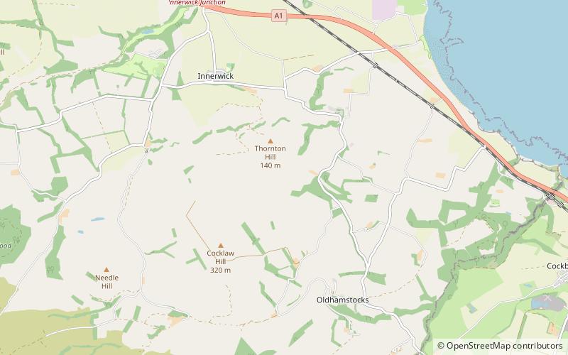
Blackcastle Hill is an Iron Age hill fort south of Innerwick, East Lothian, Scotland. It is near Cocklaw in the Lammermuir Hills at grid reference NT729724, at a height of 280 metres above sea level. The fort has a single defensive bank. ()
ScotlandUnited Kingdom
Blackcastle Hill plan & book
Unleash the traveler in you — discover the cheapest flight deals, find the perfect hotel or hostel nearby, and search for the best car rental prices. Travel at your own pace to discover new places and enjoy your journey.
Blackcastle Hill – popular in the area (distance from the attraction)
Nearby attractions include: Dunbar Castle, John Muir's Birthplace, Dunbar Harbour, Barns Ness Lighthouse.
5.3 miNWRuins, Historical place, Forts and castlesDunbar Castle, Dunbar
137 min walk • Dunbar Castle was one of the strongest fortresses in Scotland, situated in a prominent position overlooking the harbour of the town of Dunbar, in East Lothian. Several fortifications were built successively on the site, near the English-Scottish border. The last was slighted in 1567; it is a ruin today.
5.2 miNWHistory museum, MuseumJohn Muir's Birthplace, Dunbar
132 min walk • John Muir's Birthplace, in Dunbar, East Lothian, Scotland, is a museum run by East Lothian Council Museums Service as a centre for study and interpretation of the work of the Scottish-American conservationist John Muir.
5.3 miNWHarborDunbar Harbour, Dunbar
136 min walk • Dunbar Harbour is a seaport forming the north-east part of the town of Dunbar, East Lothian, Scotland. It is situated on a point projecting from the North Sea coast of East Lothian into the mouth of the Firth of Forth.
3 miNLighthouseBarns Ness Lighthouse
77 min walk • Barns Ness Lighthouse is 3.1 miles from Dunbar and was constructed by the engineers and brothers David A. Stevenson and Charles Alexander Stevenson, cousins of the novelist Robert Louis Stevenson, between 1899 and 1901.
4.9 miNW55°59'55"N • 2°30'48"WCoast to Coast Surf School, Dunbar
124 min walk • Surfing, Outdoor activities, Tours
7.3 miSWNature, Natural attraction, LakeWhiteadder Reservoir
187 min walk • Whiteadder Reservoir is a reservoir in East Lothian, Scotland, UK, in the Lammermuir Hills, 11 miles north west of Duns in the Scottish Borders, and five miles south east of Garvald. It was created to provide additional water facilities for East Lothian. Work on the Dam forming the reservoir commenced in 1964.
6.4 miNW 2.2 miEChurchDunglass Collegiate Church
57 min walk • Dunglass Collegiate Church is situated in south-east East Lothian just off the old A1 highway, one mile north of Cockburnspath in Berwickshire, Scotland, UK. It is designated as a scheduled monument.
3.9 miENature, Natural attraction, Protected areaPease Dean
101 min walk • Pease Dean is a nature reserve at Pease Bay, in the Scottish Borders area of Scotland, near the Anglo-Scottish border and Cockburnspath, Cove, and Dunglass. OS 67 NT794707. The reserve is managed by the Scottish Wildlife Trust and has two parts: Pease Burn...
4.5 miNWBrewery, NightlifeBelhaven Brewery, Dunbar
114 min walk • Belhaven Brewery is a brewery based in Belhaven, Scotland. The brewery dates from 1719, at least; by 2005 it had become the largest and oldest surviving independent brewery in Scotland.
6.7 miNWParkJohn Muir Country Park
172 min walk • The John Muir Country Park is a country park near the village of West Barns, which is part of the town of Dunbar in East Lothian, Scotland.