Whitchurch Bridge, Pangbourne

Gallery (2)
Map
Map
Gallery
Facts and practical information
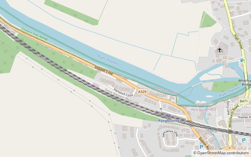
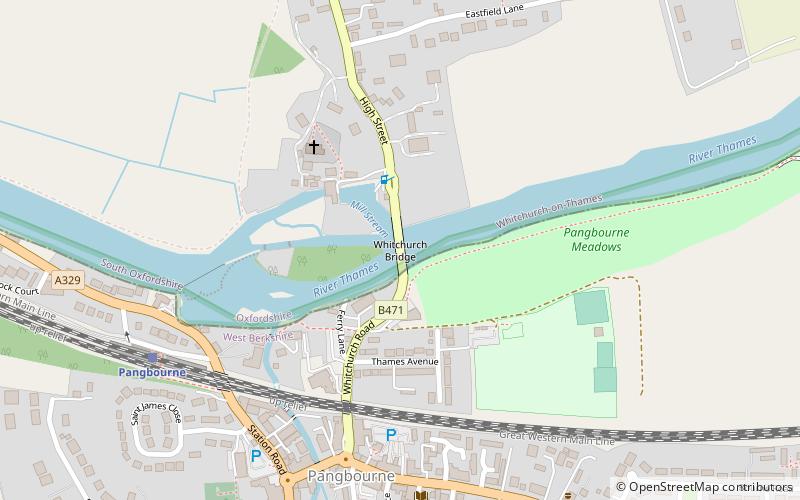
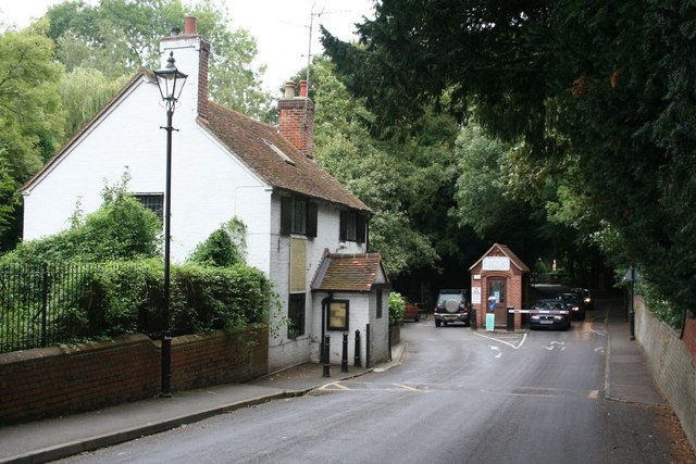
Whitchurch Bridge is a toll road bridge over the Thames in England. It links the villages of Pangbourne, Berkshire, and Whitchurch-on-Thames, Oxfordshire – crossing the river's reach above Mapledurham Lock just downstream of Whitchurch Lock. The bridge has a weight limit of 7.5 tonnes and is a Grade II listed structure. Its 1792-built, now unrelated, residential toll house is also listed. ()
Opened: 1902 (124 years ago)Height: 13 ftCoordinates: 51°29'12"N, 1°5'6"W
Address
Pangbourne
ContactAdd
Social media
Add
Day trips