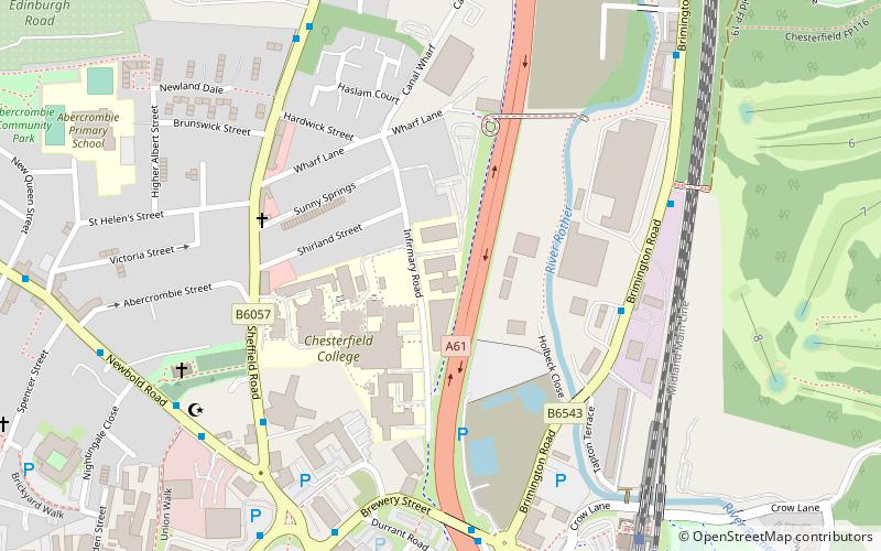
Chesterfield College, Chesterfield

Gallery (1)
Map
Map
Facts and practical information
Chesterfield College is a further and higher education college in the town of Chesterfield in North East Derbyshire, England. The college consists of a number of campuses including Infirmary Road and Lockoford Lane spread over the town of Chesterfield. The college also has satellite sites in Derby, Nottingham, Manchester and Markham Vale, Chesterfield. It serves over 21,000 students of which 5,600 are full-time attends. ()
Coordinates: 53°14'29"N, 1°25'25"W
Getting there by public transportation
Public transportation stops near this location
- Bus
- Train
 Bus
Bus
- Calculate routeBrewery Street 6 min walk
- Calculate routeDurrant Road 6 min walk
- Calculate routeStagecoach Bus Depot 6 min walk
- Calculate routeHolywell Cross 7 min walk
- Calculate routeChesterfield 7 min walk
Day trips


Frequently Asked Questions (FAQ)
Which popular attractions are close to Chesterfield College?
Nearby attractions include Chesterfield Canal, Chesterfield (4 min walk), Holy Trinity Church, Chesterfield (6 min walk), Chesterfield Museum and Art Gallery, Chesterfield (9 min walk), Christ Church, Chesterfield (9 min walk).
How to get to Chesterfield College by public transport?
The nearest stations to Chesterfield College:
Bus
Train
Bus
- Brewery Street • Lines: 54, 54A, 74, 74A, 77, 77A, X70 (6 min walk)
- Durrant Road • Lines: 54, 54A, 74, 74A, 77, 77A (6 min walk)
Train
- Chesterfield (7 min walk)