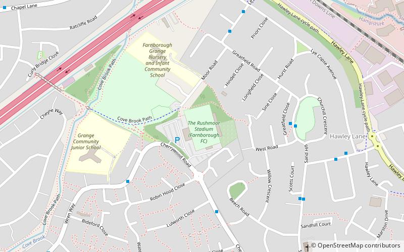
Cherrywood Road, Farnborough
Map
Facts and practical information
Cherrywood Road, known as the Easy As Hgv Stadium for sponsorship purposes, is the ground of Farnborough F.C. and the former home of Farnborough Town F.C. before the club went out of business in 2007. It lies in the town of Farnborough, Hampshire. The capacity of the ground is 7,000, with 1,927 seats. Up to the mid-1970s Farnborough Town F.C. had played at Queens Road but moved due to the lack of facilities. Cherrywood Road was newly built with the help of a local company Worldwide Carpets. ()
Capacity: 7000Coordinates: 51°18'38"N, 0°45'44"W
Address
Cherrywood RoadNorth Farnborough (Cherrywood)Farnborough
ContactAdd
Social media
Add
Getting there by public transportation
Public transportation stops near this location
- Bus
- Train
 Bus
Bus
- Calculate routeFrimley 18 min walk
- Calculate routeFarnborough 26 min walk
- Calculate routeFarnborough North 26 min walk
- Calculate routeJames Road 21 min walk
- Calculate routeLyon Way 21 min walk
- Calculate routeWatchetts Drive 22 min walk
Day trips


Frequently Asked Questions (FAQ)
Which popular attractions are close to Cherrywood Road?
Nearby attractions include Farnborough Hill, Farnborough (22 min walk), Watchmoor Nature Reserve, Camberley (24 min walk).
How to get to Cherrywood Road by public transport?
The nearest stations to Cherrywood Road:
Train
Bus
Train
- Frimley (18 min walk)
- Farnborough (26 min walk)
Bus
- James Road • Lines: 500 (21 min walk)
- Lyon Way • Lines: 500 (21 min walk)