Wellingborough School, Wellingborough
Map
Facts and practical information
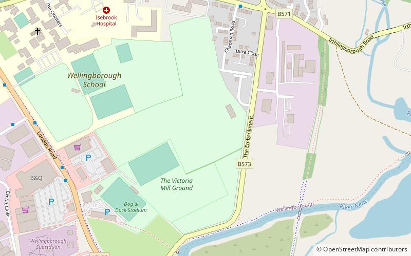
The Wellingborough School Ground is a cricket ground which was used by Northamptonshire County Cricket Club in 43 First-class matches for 45 years between 1946 and 1991, and 17 List A games between 1970 and 1991. It is now used predominantly for Women's County Twenty20 Cricket. The Thatched Pavilion which adjoins the ground features, as the last step an incoming batsman takes on the way to the wicket, a paving stone from W. G. Grace's home in Bristol. Murray Witham, a geography teacher at the school, rescued the stone from Grace's home when it was being demolished in the 1930s and brought it to the school. ()
Coordinates: 52°17'42"N, 0°40'44"W
Address
Wellingborough
ContactAdd
Social media
Add
Getting there by public transportation
Public transportation stops near this location
- Bus
- Train
 Bus
Bus
- Calculate routeThe Dog & Duck PH 7 min walk
- Calculate routeDenington Road 9 min walk
- Calculate routeBroadway 13 min walk
- Calculate routeWellingborough 16 min walk
Day trips


Frequently Asked Questions (FAQ)
Which popular attractions are close to Wellingborough School?
Nearby attractions include The Castle Theatre, Wellingborough (14 min walk), Wellingborough Museum, Wellingborough (15 min walk), Church of St Mary the Virgin, Wellingborough (15 min walk), Croyland Abbey, Wellingborough (19 min walk).
How to get to Wellingborough School by public transport?
The nearest stations to Wellingborough School:
Bus
Train
Bus
- The Dog & Duck PH • Lines: W8 (7 min walk)
- Denington Road • Lines: W8 (9 min walk)
Train
- Wellingborough (16 min walk)