Whitemoor, Nottingham
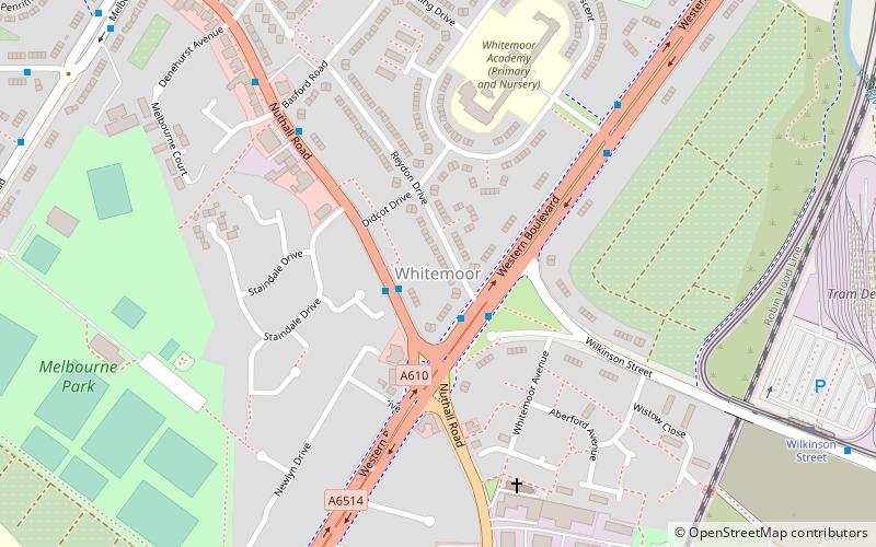
Map
Facts and practical information
Whitemoor is an area of the City of Nottingham. It lies next to Old Basford to the north, New Basford and Hyson Green to the east, Aspley to the west and Beechdale to the south. There is a primary school in the area, Whitemoor Primary School. There is a local doctors surgery and pharmacy. Local amenities include a hairdresser, corner shops, takeaways and pub. Nottingham City Transport serves the area via the 54, 70, 71, 78 and 79 services. ()
Coordinates: 52°58'26"N, 1°11'8"W
Address
BasfordNottingham
ContactAdd
Social media
Add
Getting there by public transportation
Public transportation stops near this location
- Bus
- Tram
 Bus
Bus
- Calculate routeNuthall Road 2 min walk
- Calculate routeBasford Road 6 min walk
- Calculate routeThe Whitemoor 6 min walk
- Calculate routeBar Lane 8 min walk
- Calculate routeWilkinson Street 9 min walk
- Calculate routeShipstone Street 14 min walk
- Calculate routeRadford Road 15 min walk
- Calculate routeBasford 16 min walk
Day trips


Frequently Asked Questions (FAQ)
Which popular attractions are close to Whitemoor?
Nearby attractions include St Leodegarius Church, Nottingham (6 min walk), Wilkinson Street tram stop, Nottingham (7 min walk), Melbourne Park, Nottingham (8 min walk), St Margaret's Church, Nottingham (13 min walk).
How to get to Whitemoor by public transport?
The nearest stations to Whitemoor:
Bus
Tram
Bus
- Nuthall Road • Lines: 53, Medilink (2 min walk)
- Basford Road • Lines: 78, 79, Rainbow 1 (6 min walk)
Tram
- Wilkinson Street • Lines: 1, 2 (9 min walk)
- Shipstone Street • Lines: 1, 2 (14 min walk)