Patrick Centre, Birmingham
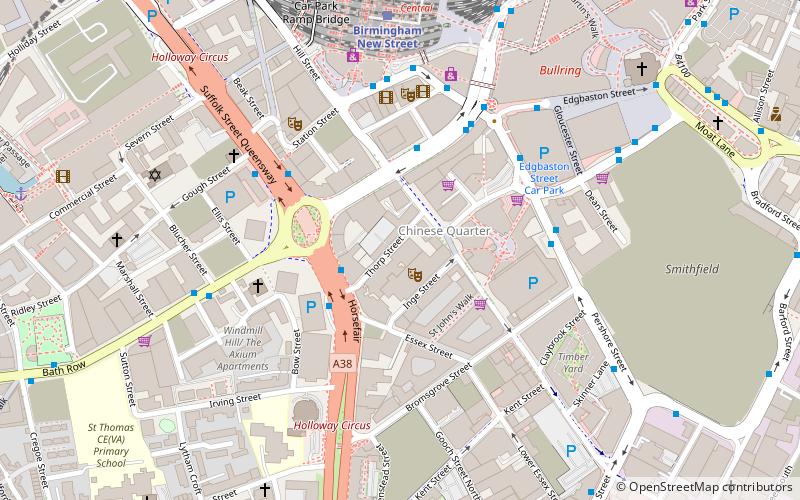
Map
Facts and practical information
The Patrick Centre for the Performing Arts is a studio theatre located on Thorp Street in the Chinese Quarter of Birmingham, England, next to the headquarters of the Birmingham Royal Ballet and the Birmingham Hippodrome. Seating 206, it is operated by DanceXchange and specialises in the staging of contemporary dance. ()
Coordinates: 52°28'29"N, 1°53'54"W
Address
NechellsBirmingham
ContactAdd
Social media
Add
Getting there by public transportation
Public transportation stops near this location
- Bus
- Tram
- Train
 Bus
Bus
- Calculate routeHf1 2 min walk
- Calculate routeHf2 3 min walk
- Calculate routeNs5 3 min walk
- Calculate routeNs9 4 min walk
- Calculate routeBirmingham New Street 6 min walk
- Calculate routeBirmingham Moor Street 11 min walk
- Calculate routeBirmingham Snow Hill 17 min walk
- Calculate routeFive Ways 17 min walk
- Calculate routeGrand Central 8 min walk
- Calculate routeCorporation Street 10 min walk
- Calculate routeTown Hall 10 min walk
- Calculate routeLibrary 13 min walk
Day trips
Patrick Centre – popular in the area (distance from the attraction)
Nearby attractions include: Corporation Street, Bull Ring, The Mailbox, Selfridges.


Frequently Asked Questions (FAQ)
Which popular attractions are close to Patrick Centre?
Nearby attractions include Birmingham Hippodrome, Birmingham (1 min walk), Hurst Street, Birmingham (2 min walk), Birmingham Back to Backs, Birmingham (2 min walk), Chinese Quarter, Birmingham (3 min walk).
How to get to Patrick Centre by public transport?
The nearest stations to Patrick Centre:
Bus
Train
Tram
Bus
- Hf1 • Lines: 63 (2 min walk)
- Hf2 • Lines: 63 (3 min walk)
Train
- Birmingham New Street (6 min walk)
- Birmingham Moor Street (11 min walk)
Tram
- Grand Central • Lines: 1 (8 min walk)
- Corporation Street • Lines: 1 (10 min walk)