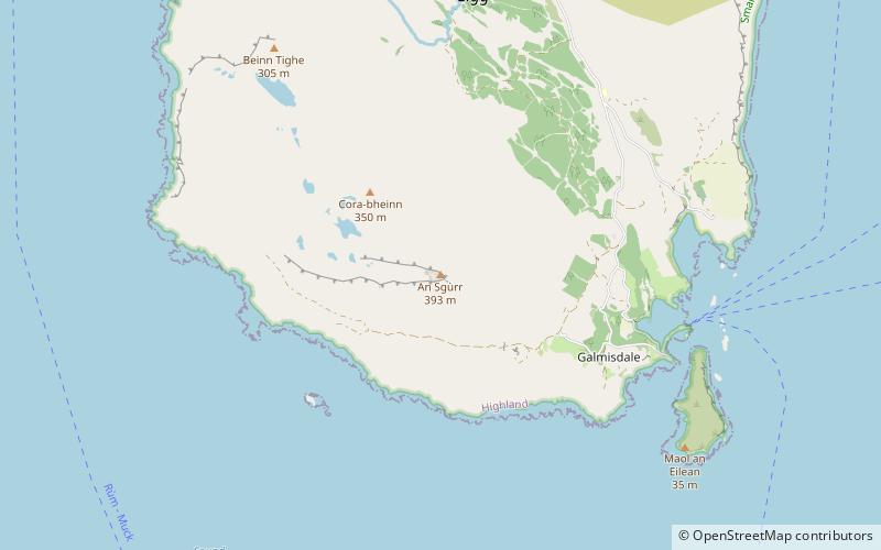
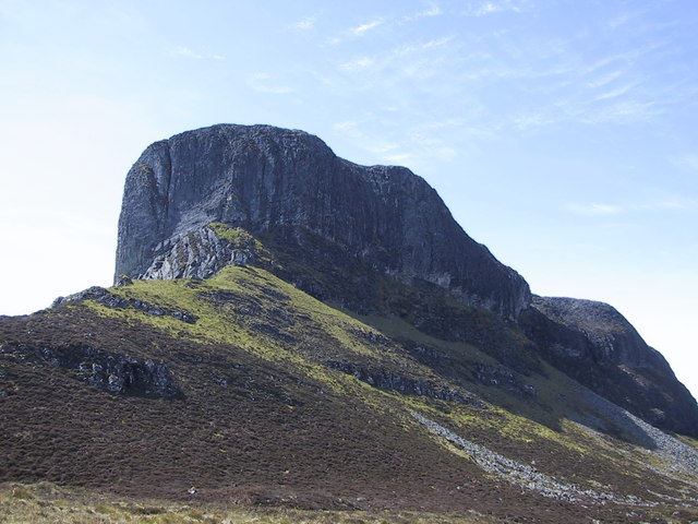
An Sgùrr, Eigg

Gallery (2)
Map
Map
Gallery
Facts and practical information
An Sgùrr is the highest hill on the Inner Hebridean island of Eigg, Lochaber, Highland, Scotland. It was formed 58.72 ± 0.07 million years ago; the result of one of the last eruptions of a volcano, the core of which now forms the Isle of Rùm. Thick viscous pitchstone lava of rhyodacitic composition flowed out, filling a river valley. The lava cooled and formed column-like structures, similar to those at Giant's Causeway. ()
Address
Eigg
ContactAdd
Social media
Add
Day trips

