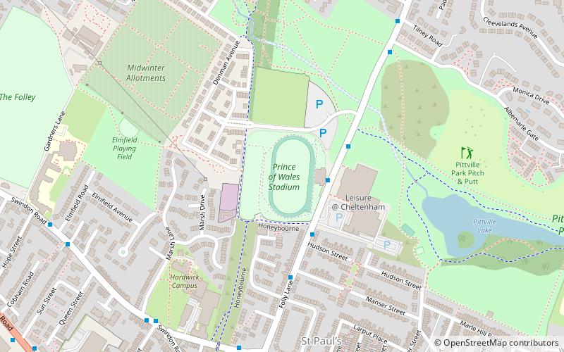
Prince of Wales Stadium, Cheltenham
Map
Facts and practical information
The Prince of Wales Stadium is a multi-sport stadium in Cheltenham, Gloucestershire, England, with a running track and athletics facilities. Since 2014, the stadium has been owned and managed by The Cheltenham Trust. ()
Coordinates: 51°54'40"N, 2°4'51"W
Getting there by public transportation
Public transportation stops near this location
- Train
 Train
Train
- Calculate routeCheltenham Racecourse 28 min walk
- Calculate routeCheltenham Spa 33 min walk
Day trips


Frequently Asked Questions (FAQ)
Which popular attractions are close to Prince of Wales Stadium?
Nearby attractions include Pittville Park, Cheltenham (8 min walk), Pittville, Cheltenham (14 min walk), Chapel Arts, Cheltenham (16 min walk), Holst Birthplace Museum, Cheltenham (17 min walk).
How to get to Prince of Wales Stadium by public transport?
The nearest stations to Prince of Wales Stadium:
Train
Train
- Cheltenham Racecourse (28 min walk)
- Cheltenham Spa (33 min walk)